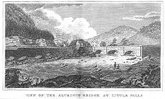
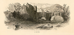
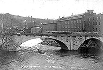
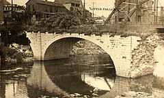
The Aqueduct at Little Falls was constructed across the Mohawk River to connect the Erie Canal (on the south side of the river) with the city itself (on the north side of the river). Travelers not stopping at Little Falls did not need to cross the aqueduct. Built at the same time as the original Clinton's Ditch canal with three equal arches (see the first image below), it was later rebuilt as part of the Enlarged Erie Canal with one large arch on the south end and another smaller one on the north end. With the building of the Barge Canal, the aqueduct was no longer necessary, and was abandoned. With ravages of time, augmented by the seasonal floods of the Mohawk River, the aqueduct slowly deteriorated until very little remains.
 |
 |
 |
| "View of the Aqueduct bridge at Little Falls" / by James Eights --
From "A Geological and Agricultural Survey of the District Adjoining the Erie Canal
in the State of New York" / by Stephen Rensselaer (Printed by Packard &
Van Benthuysen, 1824) -- courtesy of the Department of Rare Books & Special Collections,
University of Rochester Library. |
"Little Falls Aqueduct" -- from: Picturesque America, or, The land we
live in / edited by William Cullen Bryant. (Revised edition. -- New York : D. Appleton and Co.,
c1894), p. 651. |
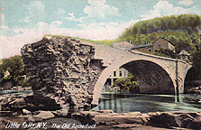
"The Old Aqueduct, Little Falls, N.Y." -
1900? -- Photograph. [CSNYS] |
| |
 |
 |
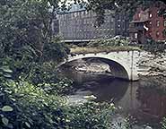 |
| "Little Falls, N.Y." [Aqueduct Bridge] -- Real Picture Postcard ;
1906-1909? [CSNYS] |
"Little Falls, N.Y., The Old Aqueduct" (3676 - The Hugh C. Leighton Co. ;
Portland Me.) -- Postcard ; postmarked Dec. 17, 1908 (but the image is probably earlier). |
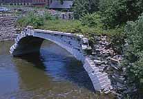
Remains of the aqueduct bridge at Little Falls -- Photograph ; 1956 [CSNYS] |
| |
 |
 |
|
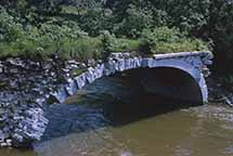
Remains of the southernmost arch of the Little Falls aqueduct -
upstream side -- Photograph ;
11 June 1960. [CSNYS Sid Beyland collection] |
|
| |
 |
 |
 |
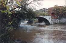
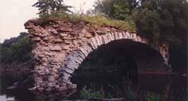
| Little Falls Aqueduct, an eastern view of the 70 foot southern arch which was
later destroyed by flood waters in 1993 -- Photograph by Howard Ohlhous, 1990. |
Little Falls Aqueduct, western side of the central arch, taken just 3 years before
it finally fell -- Photograph by Howard Ohlhous, 1990. |
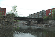
Little Falls Aqueduct remains, looking west -- Photograph by Howard Ohlhous,
May 14, 2011 -- All that can be seen of the aqueduct is a bit of the curve of the southernmost
arch and a pile of rubble. |
| |
 |
 |
|
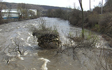
| Remains of the Little Falls Aqueduct, looking east -- Photograph ; 27 April 2011 --
The Mohawk River in flood, showing why all that remains of the central pier is this stump. |
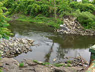
Remains of the Little Falls Aqueduct, looking southeast from the adjacent bridge --
Very litle remains of the southern pier -- Photograph ; taken 9 June 2012. |
|


