
Home | Canal System | Historical Documents | 175th Anniversary | Images | Maps | Tour | Traces | Locks | Boats | Books and Videos | Music | Links


(click on the image below to see the full-size version)
Note: The images noted [CSNYS] below are the property of and used with the permission of The Canal Society of New York State.
 |
 |
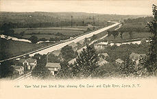 |
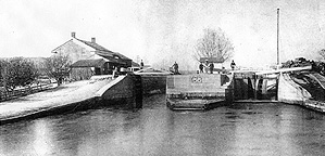
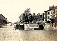
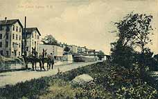
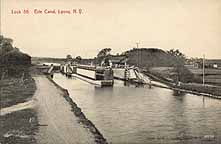
| Enlarged Erie Canal Lock No. 56 (also called the Poor House, or Poorhouse, Lock), west of Lyons, N.Y. -- Photograph taken about 1880-1887. The lock was named after the Poor House, which was located about a quarter mile west of Lock 56. Note that, in this photograph, the lock has not yet been lengthened (compare to recent photographs). It was lengthened between the 1887 and 1888 seasons. (Image courtesy of Allyn Hess Perry) | "Lock No. 55, Lyons, N.Y." -- Postcard ; not postmarked ; approximately 1904. | "View West from Stand Pipe, showing Erie Canal and Clyde River, Lyons, N.Y."
(4189 -- The Rotograph Co., N.Y. City) -- Postcard (UNDB) ; postmarked Dec. 11, 1905. Note that the Lyons Aqueduct can be glimpsed in the center of the image. Another (colored) version of this scene was published by United Art Publishing Co., New York City. [CSNYS] |
 |
 |
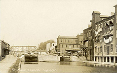 |
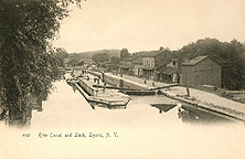
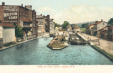
| "Erie Canal and Lock [No. 55], Lyons, N.Y." (4192, The Rotograph Co., N.Y. City) -- Postcard ; not postmarked ; approximately 1905. | "Lock 55 Erie Canal, Lyons, N.Y." (5754, Rochester News Co., Rochester, N.Y.) -- Postcard (UNDB) ; not postmarked ; approximately 1906. | "Erie Canal & Lock 55, Lyons, N.Y." -- Postcard ; not postmarked ; approximately 1906. |
 |
 |
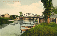 |
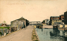
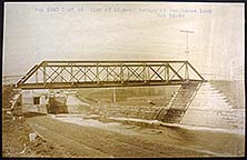
| "Lock [No. 55] on Erie Canal, Lyons, N.Y." (United Art Publishing Co., New York City) -- Postcard ; not postmarked; approximately 1908? | View of highway bridge at Poorhouse Lock, [Lyons, N.Y.] -- Oct 12, 1908 ; from: Miscellaneous Preliminary Photographs, Erie Canal, Western Division, vol. 2 [CSNYS] -- Note Lock 56 on the left under the bridge. | "Bridge at Aqueduct, Lyons, N.Y." / photo by J. F. Rooker (No. 40 -- W. E. Bourne, Lyons, N.Y.) -- Postcard ; not postmarked ; approximately 1909? -- The aqueduct can be seen behind the bridge. |
 |
 |
 |
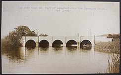
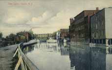
| View of Aqueduct over the Ganargua Creek, [Lyons, N.Y.] -- Oct. 12, 1908 ; from: Miscellaneous Preliminary Photographs, Erie Canal, Western Division, vol. 2 [CSNYS] | "Erie Canal, Lyons, N.Y." (A66443 -- no publisher information) -- Postcard ; not postmarked ; approximately 1908? [CSNYS] | "Along Erie Canal, Lyons, N.Y." / Photo by J. F. Rooker (No. 32 -- W. E. Bourne, Lyons, N.Y.) -- Postcard ; postmarked Dec. 20 - 10, [1910]. A black and white version. [CSNYS] |
 |
 |
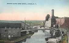 |
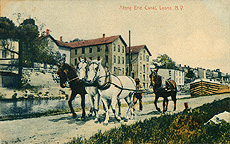
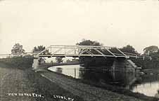
| "Erie Canal, Lyons, N.Y." (no publisher information) -- Postcard ; not postmarked ; approximately 1910? [CSNYS] | "View on the Erie, Lyons, N.Y." -- Real Photo Postcard ; not postmarked ; approximately 1910? [CSNYS] | "Docks Along Erie Canal, Lyons, N.Y." / photo by J.F. Rooker (no publisher information) -- Postcard ; not postmarked ; approximately 1911? [CSNYS] |
 |
 |
|
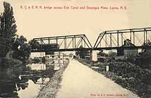
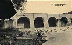
| "R.S.&E.R.R. bridge across Erie Canal and Ganargua River, Lyons, N.Y." / Photo by J.F. Rooker, Lyons, N.Y. (no publisher information) -- Postcard ; not postmarked ; approximately 1911? [CSNYS] | "Lock 56, Erie Canal, Lyons, N.Y." / photo by J.F. Rooker, Lyons, N.Y. (A35713 -- no publisher information) -- Postcard ; not postmarked ; approximately 1912? [CSNYS] | "The Five Arch Culvert, Lyons, N.Y." [Lyons Aqueduct] -- 1925? ; Source unknown. |

The following images show the Erie (Barge) Canal which replaced the older Enlarged Erie Canal.

 |
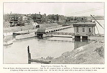
Right: "View at Lyons, showing numerous structures -- lock No. 27, a power house, a Taintor gate by-pass, a foot bridge and a highway bridge over the canalized Clyde river. At the [upper] left the old canal with a lock and two bridges is seen." -- from: Annual Report of the State Engineer and Surveyor of the State of New York for the fiscal year ended September 30, 1914 (Albany : J.B. Lyon Co., printers, 1915) -- facing p. 18. See also another version. |
 |
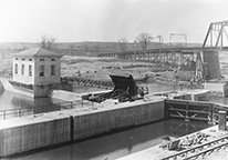
| Lock E-27, Lyons, N.Y. -- 1914? ; view of the lock chamber and Taintor gate. [CSNYS] |
||
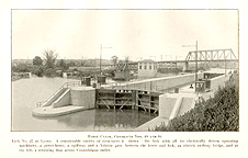 |
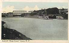 |
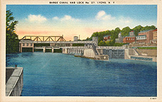 |
| "Barge Canal, Contracts Nos. 48 and 94. Lock No. 27 at Lyons." -- from Annual Report of the State Engineer and Surveyor of the State of New York for the fiscal year ended September 30, 1915 (Albany : J. B. Lyon Co, printers, 1916) -- facing p. 262. | "Lock 27 'Barge Canal,' Lyons, N.Y." (no publisher information) -- Postcard ; postmark undecipherable ; approximately 1918? [CSNYS] | "Barge Canal and Lock No. 27, Lyons, N.Y." (E-8077 -- Wm. Jubb Co., Syracuse, N.Y.) -- Postcard ; not postmarked ; approximately 1920? |
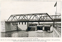 |
 |
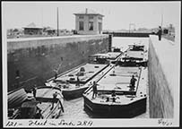 |
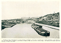
| "Canal structures at Lyons" -- from: Annual report of the State Engineer and Surveyor for the year ended June 30, 1919 / State of New York (Albany : J.B. Lyon Co., printers, 1920) -- facing p. 176. | "Example of many canal structures in close proximity, at Lyons -- from: History of the Barge Canal of New York State / by Noble E. Whitford; supplement to the Annual report of the State Engineer and Surveyor for the year ended June 30, 1921 (Albany : J.B. Lyon Co., printers, 1922) -- opposite p. 392. | Fleet in Lock E-28A, Lyons, N.Y. -- Aug. 4, 1921 ; from: 1922 Barge Canal Album [CSNYS] |
 |
 |
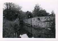 |
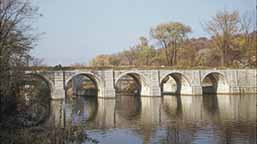
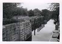
| "Aqueduct at Lyons" -- Photograph ; 1952 [CSNYS] | "[Lock 56, Lyons, N.Y. - looking east]" -- Photograph ; approximately 1954? [CSNYS] | "[Lock 56, Lyons, N.Y. - looking west]" -- Photograph ; approximately 1954? [CSNYS] |
 |
 |
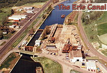 |
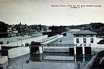
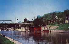
| "Barge Canal Lock No. 27 and Power House, Lyons, N.Y." (no publisher information) -- Postcard ; not postmarked ; approximately 1950? [CSNYS] | "[Lock 27, Lyons, N.Y.]" (no publisher information) -- Postcard ; not postmarked ; approximately 1960? [CSNYS] | "Erie Canal Lock 28A & Dry Dock at Lyons, NY" (L-21636-E -- Don Hunt Aerials, Wolcott, N.Y.) -- approximately 1990? |
 |
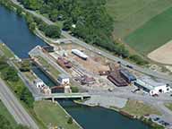 | |
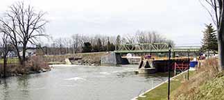
| Lock E-27, Lyons, N.Y. - looking west -- Photograph ; taken 31 March 2007. | Aerial photo of Lock E-28A, the adjacent drydock and the Canal Corporation shops, Lyons N.Y. -- 2018? [CSNYS] | |

For photographs of the remains of Enlarged Erie Canal Lock No. 56 west of Lyons, see Enlarged Erie Canal Lock No. 56 in the Traces section of this web site.
For photographs of the remains of the Lyons Aqueduct, see The Lyons Aqueduct in the same section.
 |
 |
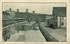 |
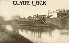
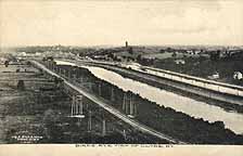
| "Clyde Lock" [Lock No. 53] -- Real Photo Postcard ; not postmarked ; approximately 1900? | "Bird's Eye View of Clyde, N.Y." (C.A. Sherman, druggist) -- Postcard ; not postmarked ; approximately 1901? [CSNYS] | "Erie Canal, Clyde, N.Y." (no publisher information) -- Postcard ; not postmarked ; approximately 1902? [CSNYS] |
 |
 |
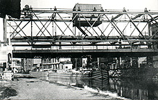 |
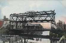
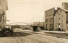
| "Glasgow St. Lift Bridge, Clyde, N.Y." (pub. by Graham Drug Store) -- Postcard ; postmarked 1903. A variant black and white version pub. for C.A. Sherman, druggist. [CSNYS] | "Bridge & Erie Canal, Clyde, N.Y." (pub. for Graham Drug Store) -- Postcard ; not postmarked ; approximately 1903? [CSNYS] | "[The Erie Canal in Clyde, N.Y. - Looking West]" (no publisher information) -- Postcard ; not postmarked ; approximately 1904? [CSNYS] |
 |
 |
 |
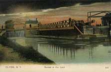
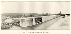
| "Clyde, N.Y. -- Sunset at the Lock" [Lock 53] (4047 - no publisher information) -- Postcard ; not postmarked ; approximately 1905? [CSNYS] | "Barge Canal, Contract No. 47. Lock No. 26 and dam in Clyde river,
near Clyde" -- from: Annual report of the State Engineer and Surveyor of the State of
New York for the fiscal year ended September 30, 1912. (Albany : J.B. Lyon Co., printers, 1913) -- facing p. 228. |
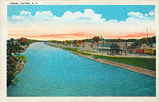
"Canal, Clyde, N.Y." (128008 -- Tichnor Quality Views) -- Postcard ; not postmarked ; approximately 1915-1920? |

For photographs of the remains of Enlarged Erie Canal Lock No. 53 west of Clyde,
see Enlarged Erie Canal Lock No. 53 in the Traces section
of this web site.

The second longest of the Erie Canal aqueducts, the Seneca River Aqueduct was 840 feet, 5 1/2 inches long. Thirty piers and two abutments of Onondaga limestone supported a heavy timber trough which carried canal water over the river. Thirty-one stone arches supported the towpath. Construction began in January 1849, and the completed aqueduct was brought into use in Spring 1857. Located in the town of Montezuma in Cayuga County, N.Y., the aqueduct was designed by and built under the direction of Van R. Richmond, State Engineer and Surveyor, and thus is also known as the Richmond Aqueduct. When the Enlarged Erie Canal was replaced by the Barge Canal in 1917, part of the aqueduct was torn down to give boats clear run of the river, which serves as the canal of today. Today, seven arches remain on the east shore and three arches remain on the west shore.
'Regarding the Seneca River aqueduct, "Mr. Richmond explained that before designing the aqueduct plan, records had been kept so that they knew approximately the maximum flow of water that would have to be provided for. ... Mr. Richmond said that in making his calculations he found that 25 spans or openings, 22 feet wide and 11 feet deep under the trunk of the aqueduct, would pass the biggest floods recorded previous to that time without backing up the water to any appreciable extent, but to be on the safe side and provide for greater floods, he added six more spans, making the number 31 instead of but 25, as at first proposed.
At the highest stages of the water since the aqueduct was built, careful measurements resulted in finding that the surface of the river was not quite 1 1/4 inches higher on the upstream side of the aqueduct than it was on the downstream side. ...' -- From: History of the canal system of the State of New York ... / by Noble E. Whitford. (Albany : Brandow Printing Co., 1906) v. 1, p. 801.

For recent photographs of the remains of the Seneca River Aqueduct, see The Seneca River Aqueduct page in the Traces section of this web site.
.
For photographs of the remains of the Port Byron aqueducts, see Port Byron Aqueducts, Port Byron, N.Y.,
and for photographs of the remains of Enlarged Erie Canal Lock No. 52 in Port Byron,
see Enlarged Erie Canal Lock No. 52 , both in the Traces section of this web site.

For photographs of the remains of the Centreport Aqueduct (between Weedsport and Port Byron, N.Y.),
see The Centreport Aqueduct page in the Traces section of this web site.

For photographs of the remains of the Jordan lock (Lock 51, west of Jordan), see the Enlarged Erie Canal Lock No. 51 page.
For photographs of the remains of the Jordan Aqueduct, see The Jordan Aqueduct page in the Traces section of this web site.

For recent photographs of the Nine Mile Creek Aqueduct (west of Camillus), see the
Camillus Erie Canal Park page in the Traces section of this web site.
For photographs of the
remains of Gere's Lock (Lock 50), see the Enlarged Erie Canal Lock No. 50 page.
http://www.eriecanal.org/westcentral-2.html