
Home | Canal System | Historical Documents | 175th Anniversary | Images | Maps | Tour | Traces | Locks | Boats | Books and Videos | Music | Links

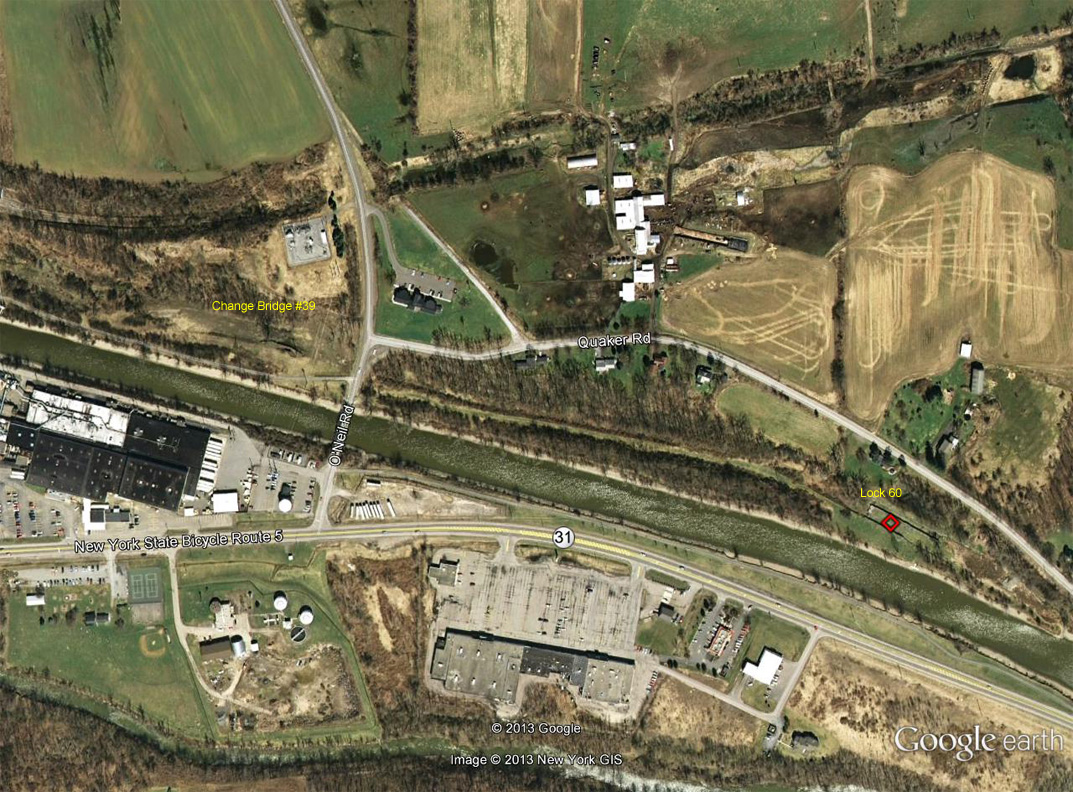
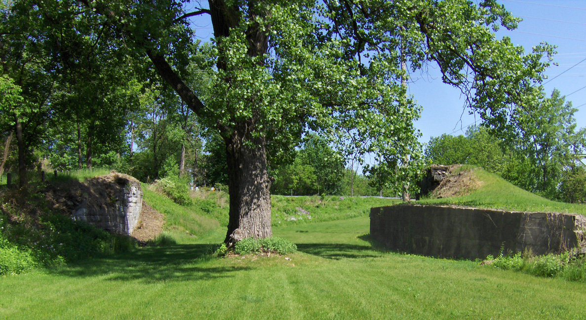
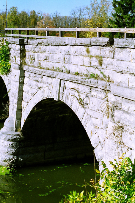
Enlarged Erie Canal Change Bridge No. 39, also known as Gallup's Bridge, is located just east of the Village of Macedon in Wayne County. The bridge allowed the towpath to switch from one side of the canal to the other during the Enlarged Erie Canal era (1840-1905). West of the bridge, the towpath was on the south side of the canal, and east of the bridge, the towpath was on the north side. The bridge served a dual purpose, being a highway bridge carrying the main highway between Macedon and Palmyra as well. The bridge was an iron lattice truss with a wood floor, and was built in 1881. For further details see the historical marker in the right-hand picture below.
The following photographs of Gallup's Bridge were taken in May 2013.
 |
 |
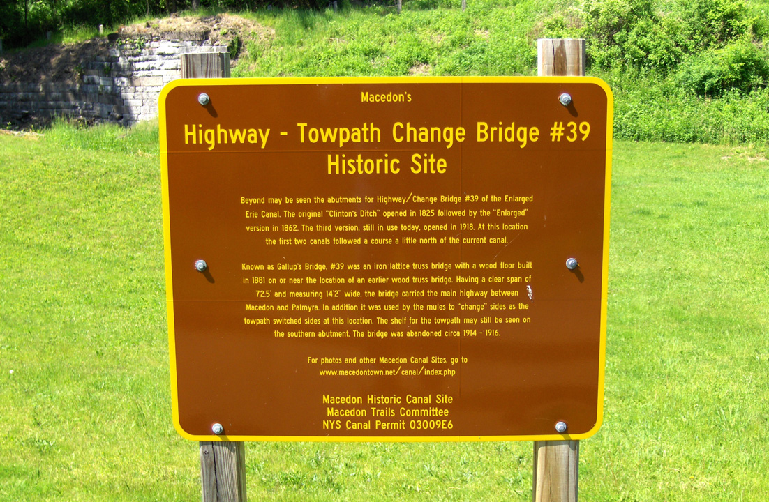 |
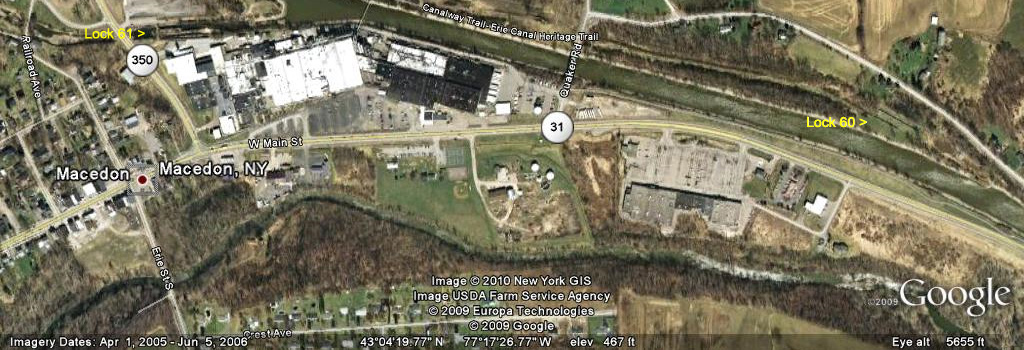
| Google Earth views of Enlarged Erie Canal Change Bridge no. 39 (Gallup's Bridge) ; in the left view, the change bridge is on the left, and Enlarged Erie Canal Lock No. 60 is on the right. | Historical marker at Enlarged Erie Canal Change Bridge no. 39 (Gallup's Bridge) just west of Lock 60. | |
 |
 |
|
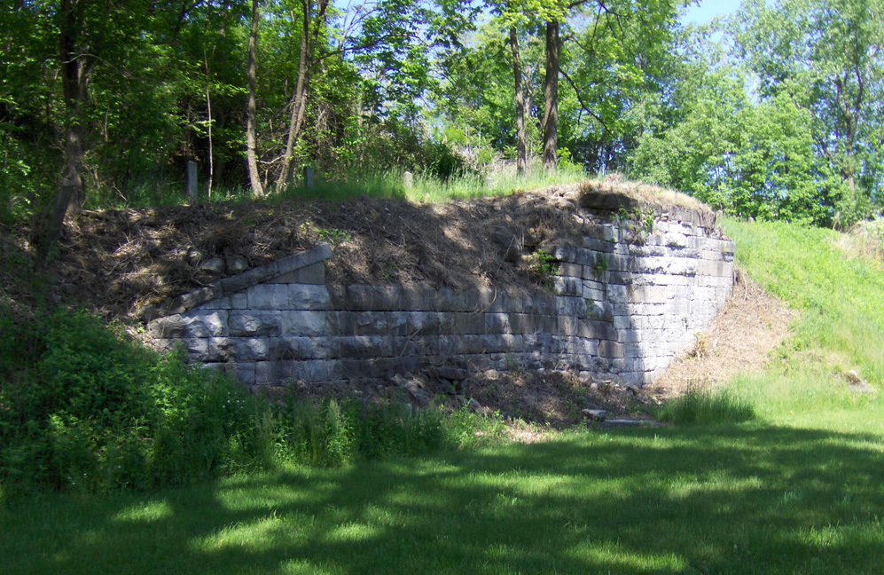 |
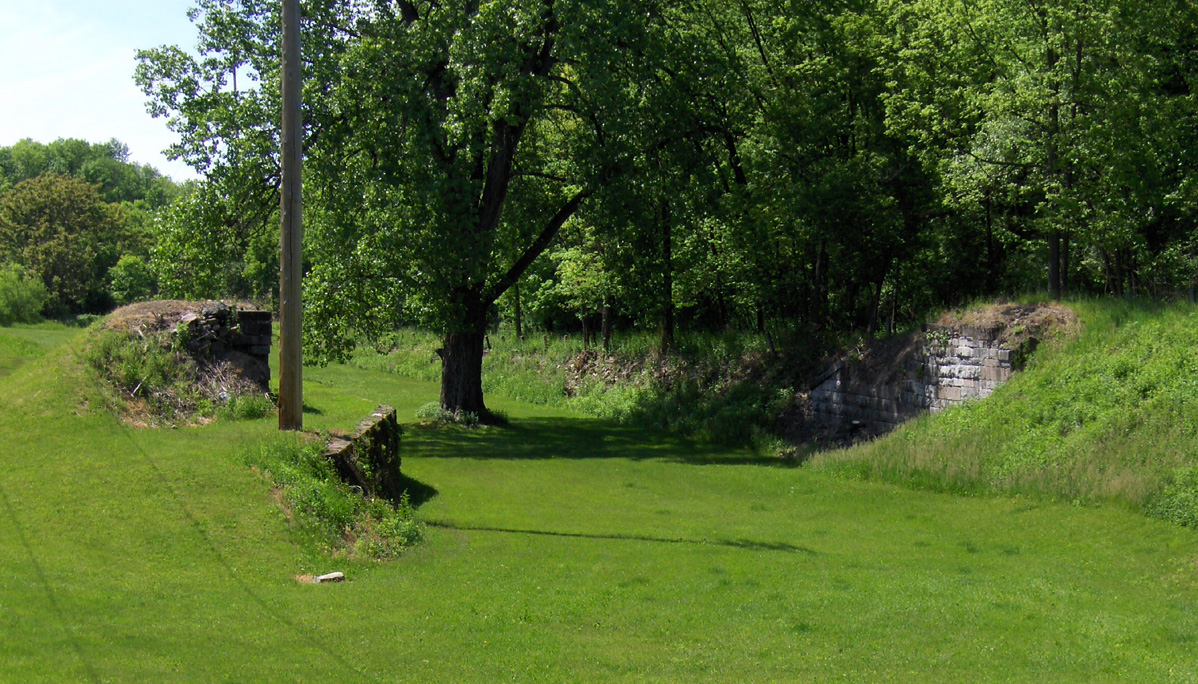
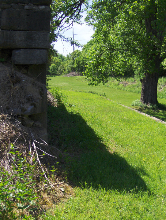
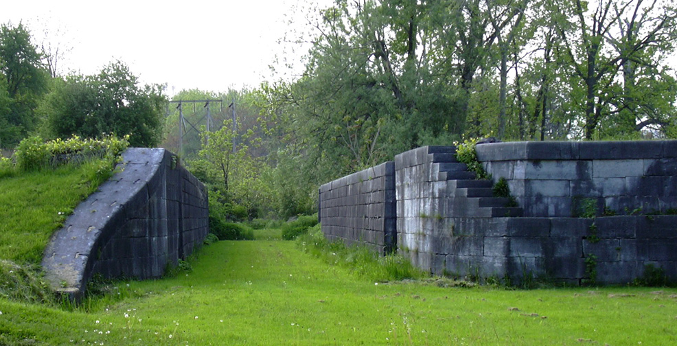
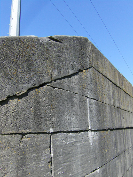
| Remains of Enlarged Erie Canal Change Bridge no. 39, looking west. The towpath goes under the bridge just to the right of the south abutment. | The towpath under the bridge, looking west from the base of the southern abutment. | Looking east from within the canal prism. | Looking north at the north abutment. |
| Mules towing boats going west would cross the bridge from the north side to the south side, and curl around to their left, passing under the bridge on the towpath just to the side of the south abutment (right side in the first picture, or left side in the third picture). | |||

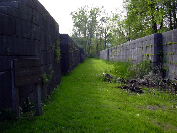
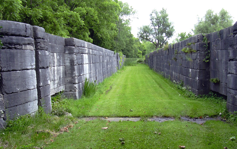
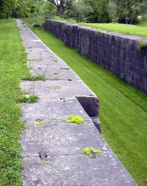
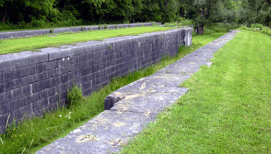
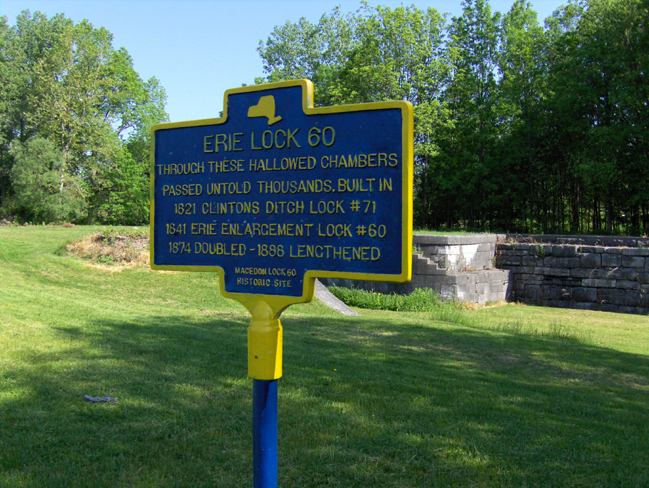
Enlarged Erie Canal Lock No. 60 (also called the Lower Macedon lock) is located a mile east of the village of Macedon, NY on the north side of the existing Erie Canal, which parallels NY Route 31 at this point. It was built in 1841 as a single chamber lock with a 10 foot lift, replacing the original 1822 Clinton's Ditch lock. It was doubled in 1874, and the north chamber was lengthened at the foot (eastern) end in 1888. The towpath was on the south side. It was in use until 1914.
At present, the lock remains and surrounding area are maintained as a small park. Access to the park can be gained either from a dock on the existing Erie Canal or from Quaker Road.
 |
 |
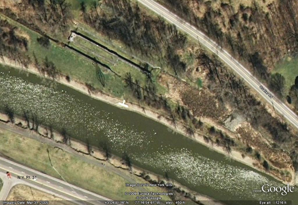 |
| Above and right: Google Earth view of Macedon and the remains of Lock 60. |
Below are some photographs of Enlarged Erie Canal Lock No. 60 taken in 2003 and 2004. Click on the image below to see the full-size version.
 |
 |
 |
| Enlarged Erie Canal Lock No. 60 --
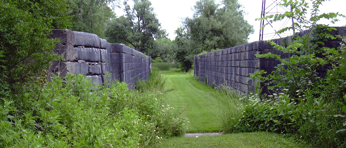
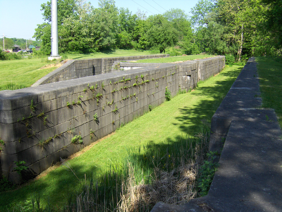
North (lengthened) chamber Left: looking west towards Rochester from within the canal prism ; Middle: looking east towards Albany from within the canal prism ; Right: looking east from the heelpath. | ||
 |
 |
 |
| Enlarged Erie Canal Lock No. 60 -- South
(single length) chamber Left: looking east from the towpath level (the north chamber can be seen to the left) ; Middle: looking west from within the canal prism ; Right: looking east from within the canal prism. | ||
The following photographs of Enlarged Erie Canal Lock No. 60 were taken in May 2010.
 |
 |
 |
| Historical marker at Enlarged Erie Canal Lock 60, Macedon, NY ; Lock 60 can be seen in the background, looking northwest. | Enlarged Erie Canal Lock 60, looking southwest from the north wall of the extended north chamber. | East end of the south wall of the south chamber -- the groove was caused by the rubbing of tow ropes. |
Enlarged Erie Canal Lock No. 61 (also called the Upper Macedon lock) is located at the eastern edge of the business district of Macedon, N.Y., just north of the junction of Route 31 and Route 31F/350, and just south and across the road from Lock No. 30 of the present Erie Canal. The lock is a double-chamber lock, with the north chamber double-length, and had a lift of 6.69 feet to the west. West of the lock and Route 31F/350 is an undisturbed stretch of the Enlarged Erie Canal. Lock No. 61 is currently used as a spillway for the present Lock No. 30, but is otherwise not maintained.
For more information and pictures of Lock No. 61, see Enlarged Erie Canal Lock No. 61 in the Traces section.
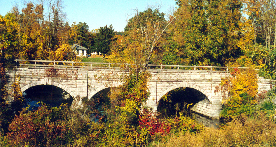
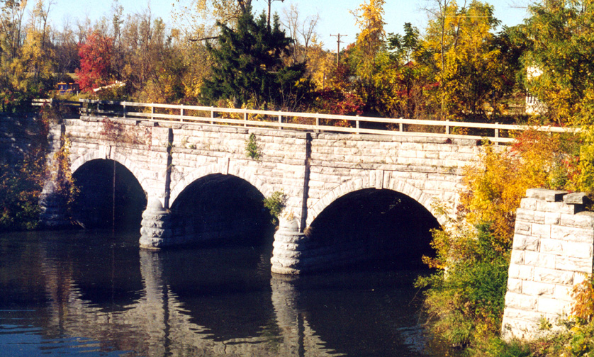
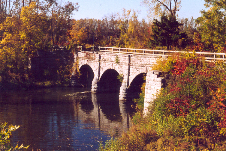
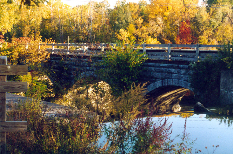
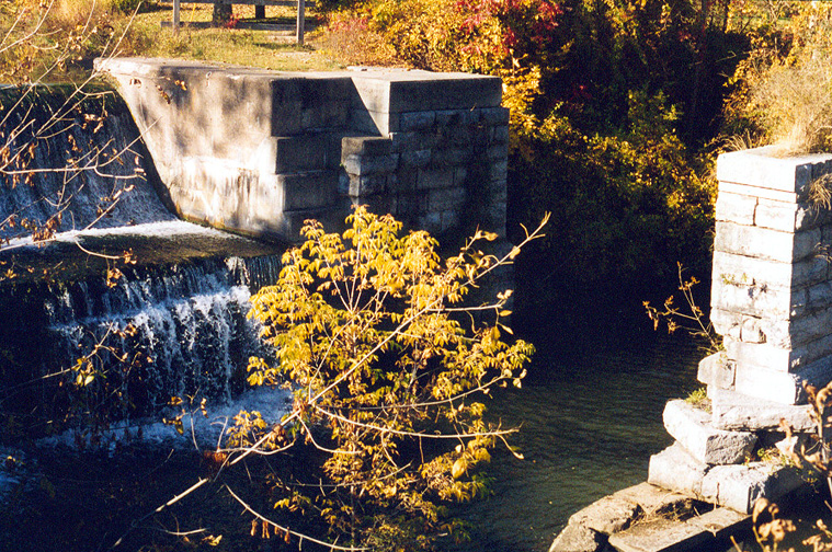
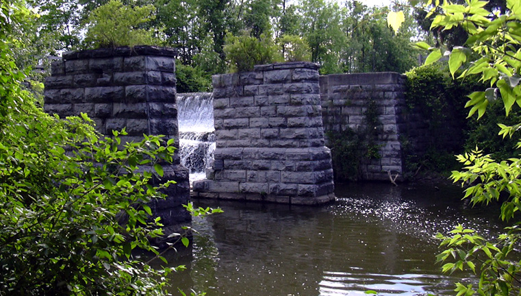
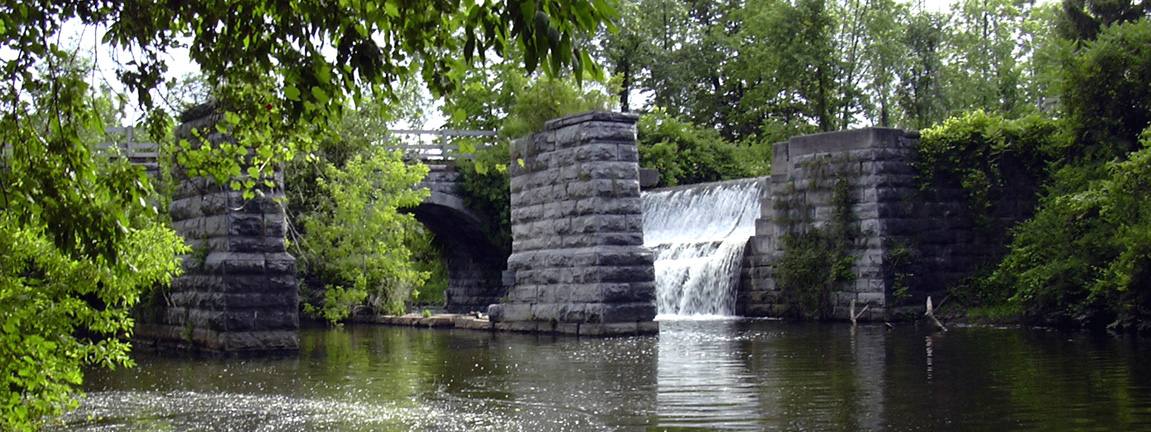
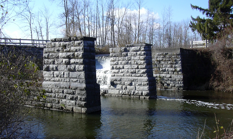
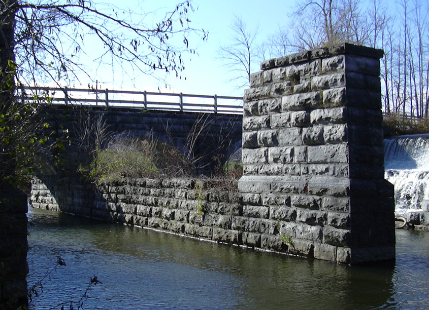
The Mud Creek Aqueduct is located in Aqueduct Park, just west of the Village of Palmyra, NY, north of NY Route 31, and adjacent to existing Erie Canal Lock No. 29. The remains of the aqueduct include the towpath bridge, on the south side of the canal, now a part of a walking trail, and the stone supports for the (now missing) wooden canal prism, which held the water, on the north side. The aqueduct was built in 1857, is 94 feet long, and uses three 24-foot spans to cross the creek, which is officially called Ganargua Creek. Below are some photographs of the Mud Creek Aqueduct taken Fall 2003, Summer 2005, Fall 2006 and Fall 2007.
For the original plans for the Mud Creek Aqueduct, see The Aqueduct in the 175th Anniversary: Making It Work section.
 |
 |
 |
| The Mud Creek Aqueduct, Palmyra, NY-- the south side as seen from NY Route 31. The white building in the background is the current lock house | ||
| | ||
 |
 |
|
| The Mud Creek Aqueduct -- the north side. In the lower right is the water level of the old Enlarged Erie Canal. |
The Mud Creek Aqueduct -- the north side (picture taken by Irene Grindall). | |
| | ||
 |
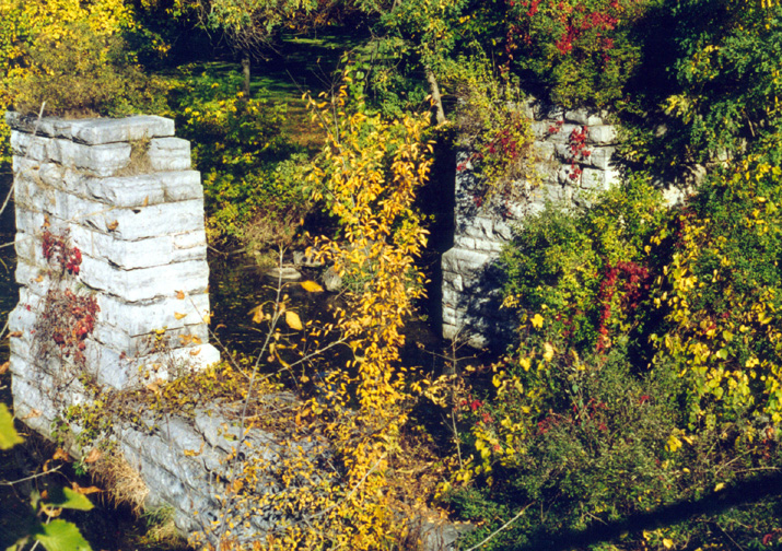 | |
| The supports for the canal prism for the Mud Creek Aqueduct -- Above left: western end from the tow path level ; Above right: eastern end from the tow path level Below: the supports from the north, seen from the creek level The top of the waterfall in these pictures is the water level of the old canal. | ||
 |
 | |
| | ||
 |
 | |
| The Mud Creek Aqueduct, looking southwest from the creek level.(Nov.2006) | ||
| | ||
 |
 |
 |
| The Mud Creek Aqueduct, looking west from the towpath level (Oct. 2007) | ||
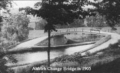
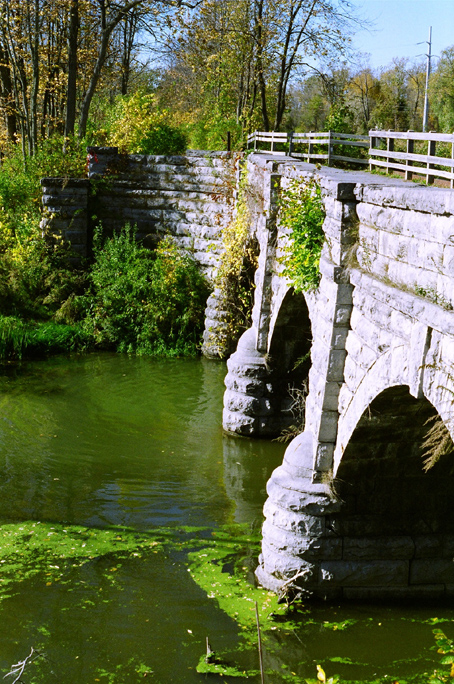
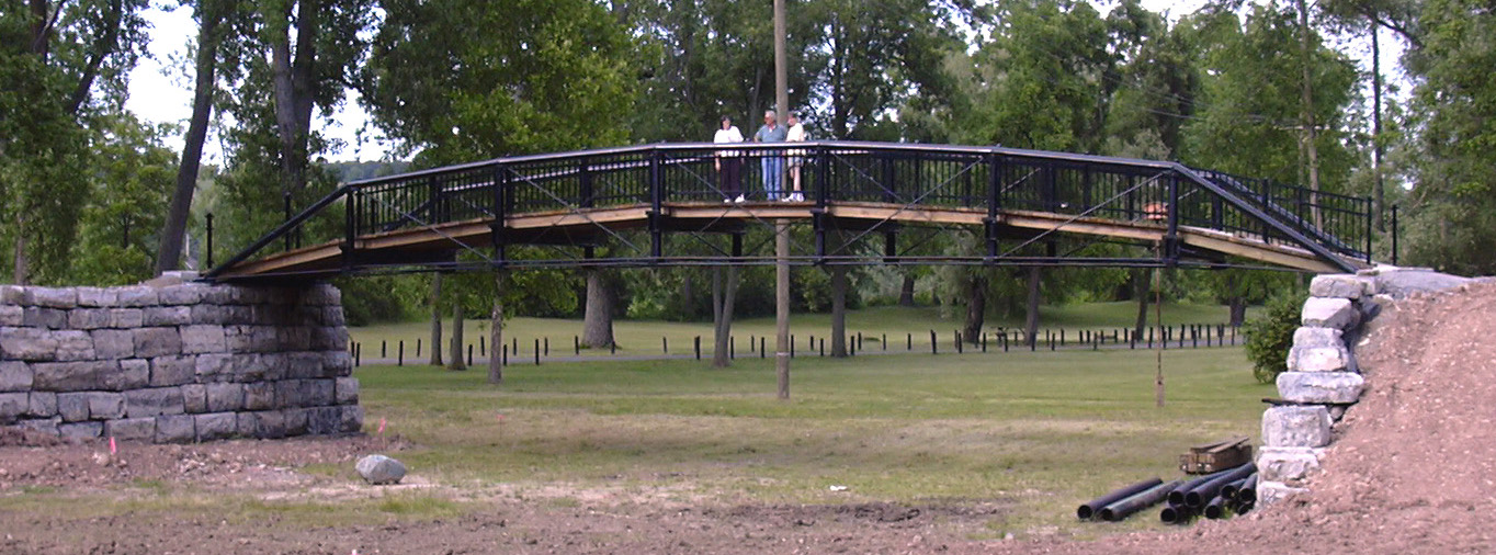
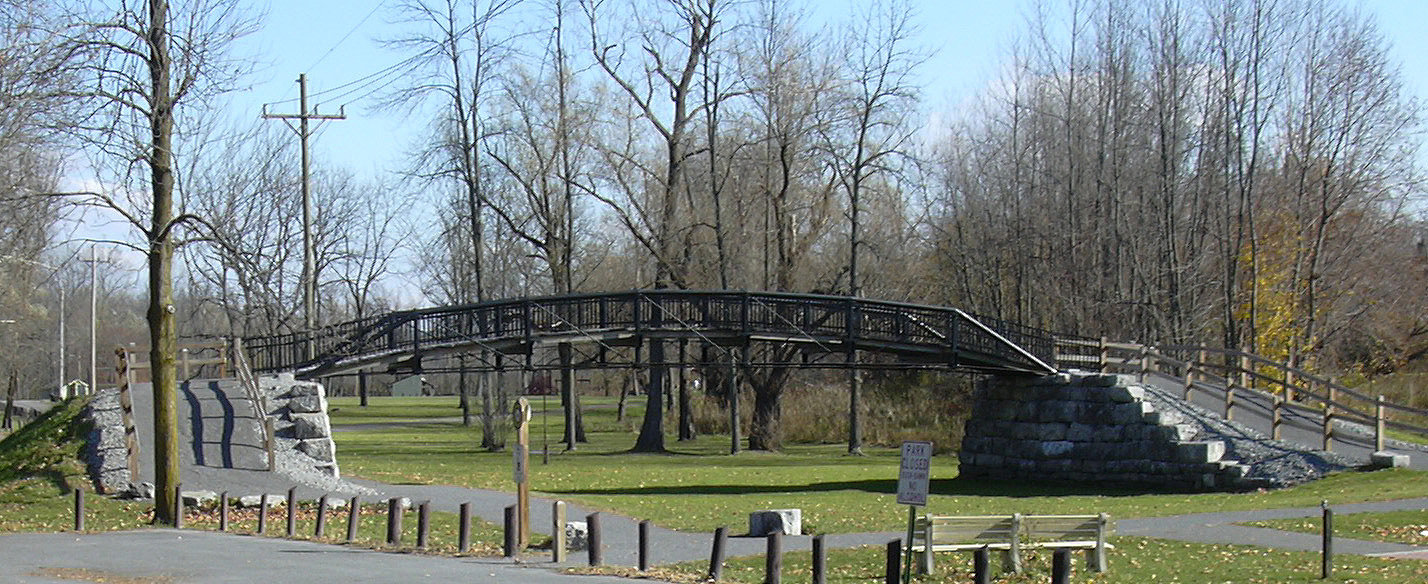
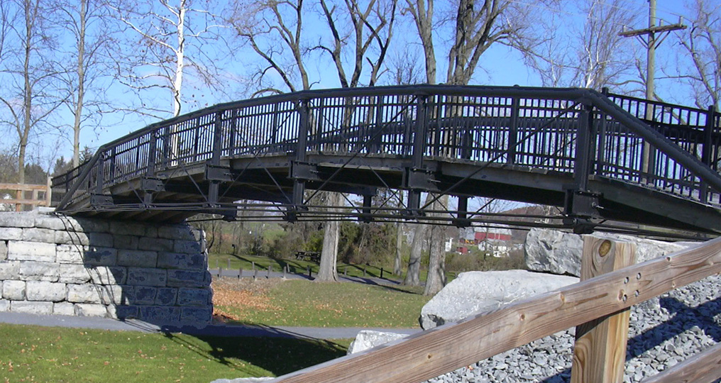
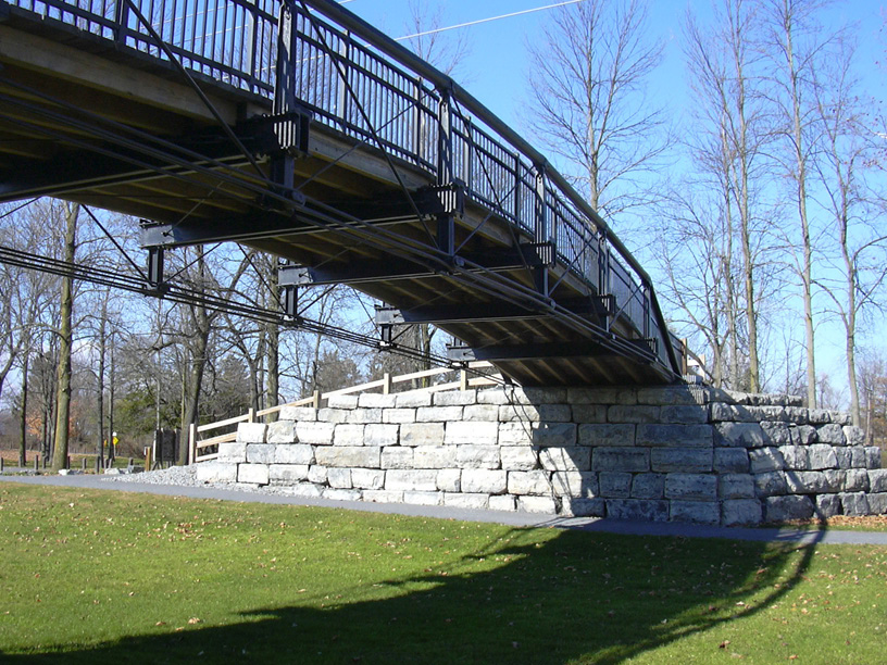
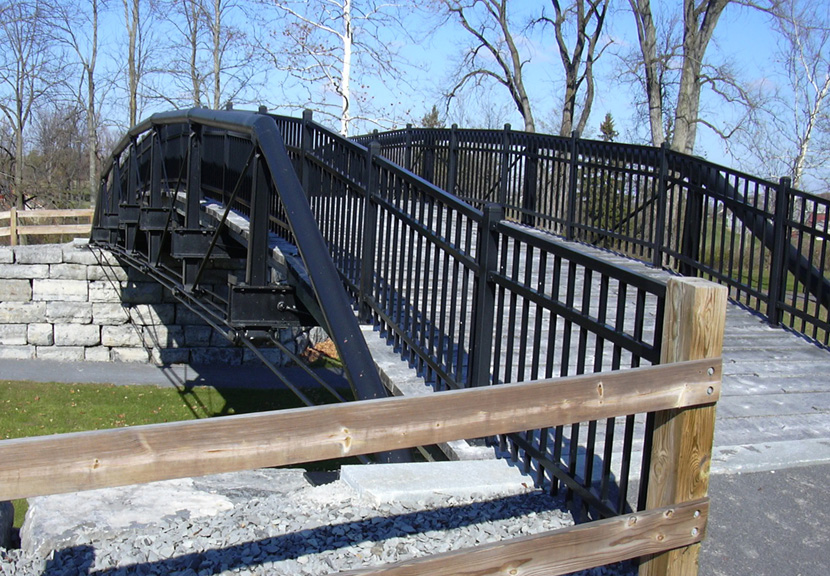
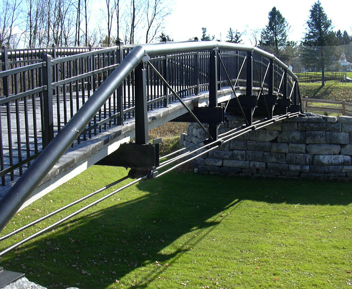
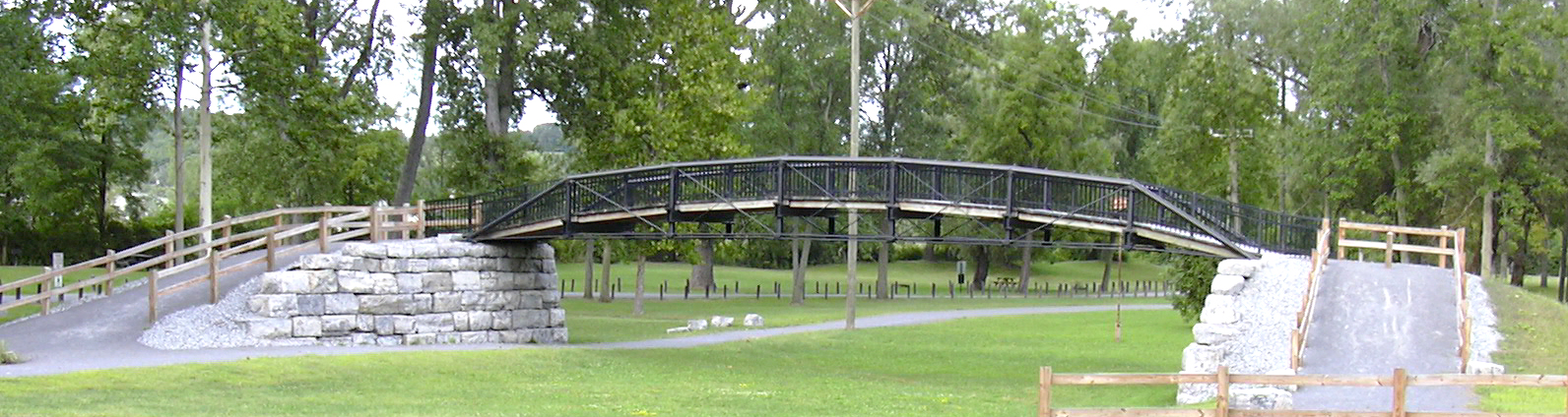
Aqueduct Park also includes the reconstructed Aldrich Change Bridge No. 35, which allowed the towpath to switch from one side of the canal to the other during the Enlarged Erie Canal era (1840-1905). West of this bridge, the towpath was on the south side of the canal, and east of the bridge, on the north side. Originally entirely on the south side of the canal, the enlargement left no room between the enlarged canal and adjacent buildings in Palmyra, so the towpath was switched to the north side through the village.
First erected in1858, the Aldrich Towing Path Change Bridge is the oldest iron bridge in New York State and one of only two bridges known to survive from the first enlargement of the Erie Canal. In addition to its importance as an artifact of one of the nation's earliest and most significant public works, it draws attention to one of the lesser known and largely overlooked designs of Squire Whipple, nineteenth-century America's foremost theoretician-practitioner of truss bridge design. (See the Making It Work: The Bridge page for more information on the Whipple bridge.) The bridge was fabricated in the Waterford, New York iron works of George W. Eddy and erected by John Hutchinson of Troy as part of a two-span towing path change bridge at the Rochester weighlock. In 1879, the bridge was removed and placed in storage. After the collapse of the wooden change bridge just west of Palmyra, one span of Hutchinson's bridge was shortened and placed in service as Bridge No. 35, in which role it served until the downtown Palmyra section of the first enlargement was bypassed. Sold to a farmer in 1915, who erected it across Ganargua Creek, it served as a farm bridge until approximately 1970, when it was abandoned. After it had been washed from its abutments by ice and high water in 1996, it was salvaged, dismantled, stored, and finally re-erected in Aqueduct Park in 2003 and 2004.
A more detailed history of the Aldrich Towing-Path Change Bridge is extracted from the Historic American Engineering Record document, HAER, NY,59-PALM,1-
 |
 |
| Above: The Aldrich Change Bridge in early 2004 ; Below: The Aldrich Change Bridge in Fall 2006. | |
 |
 |
 |
 |
 |
 |
 | |
For historical images of the Erie Canal through Macedon and Palmyra,
see the Images of the Erie Canal in Macedon and Palmyra
section of the Images of the Erie Canal between Rochester and Syracuse page.
http://www.eriecanal.org/MacedonPalmyra.html
