
Home | Canal System | Historical Documents | 175th Anniversary
Images | Maps | Tour | Traces | Locks | Boats | Books and Videos | Music | Links


 | |
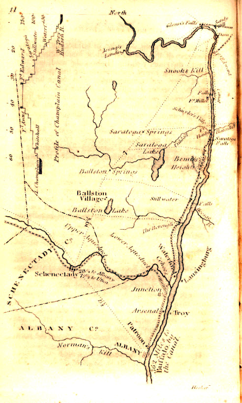
| Map and profile of the Erie Canal -- Originally published in: Laws of
the State of New York, in relation to the Erie and Champlain canals / Published by authority, under the direction of the Secretary of State (E. and E. Hosford, printers, Albany, 1825) | |
 |
Map and profiles of New-York State Canals -- designed under direction of Van Rensselaer Richmond, State Engineer & Surveyor, to accompany his report for 1859. Originally published in: Annual report of the New York State Engineer and Surveyor (C. Van Benthuysen, Albany, 1860) |
 |
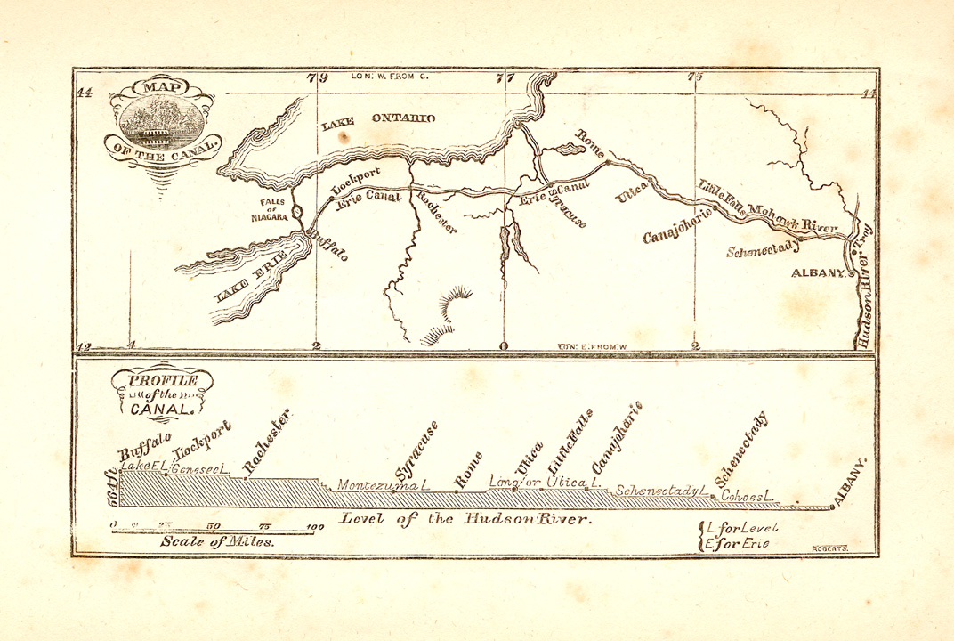
New York : [with] Profile of the Champlain Canal from Lake Champlain to the Hudson River [and] Profile of levels of the Grand [i.e. Erie] Canal. (pub. by New York State, Albany, 1825) |
 |
 |
 |
 |
 |
 |
 |
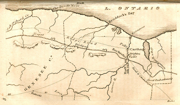
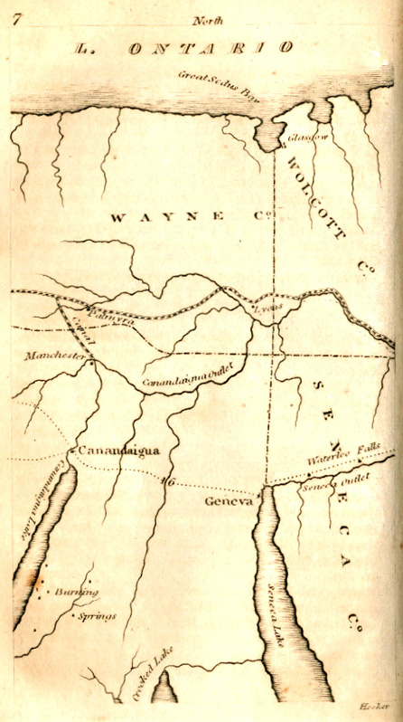
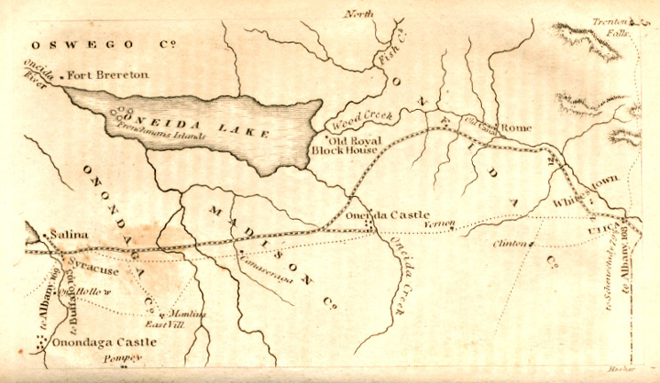
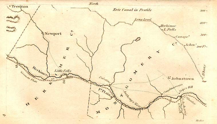
| Maps from The Northern Traveller and Northern Tour, New ed. published by J. & J. Harper, 1831. | ||||||
 |
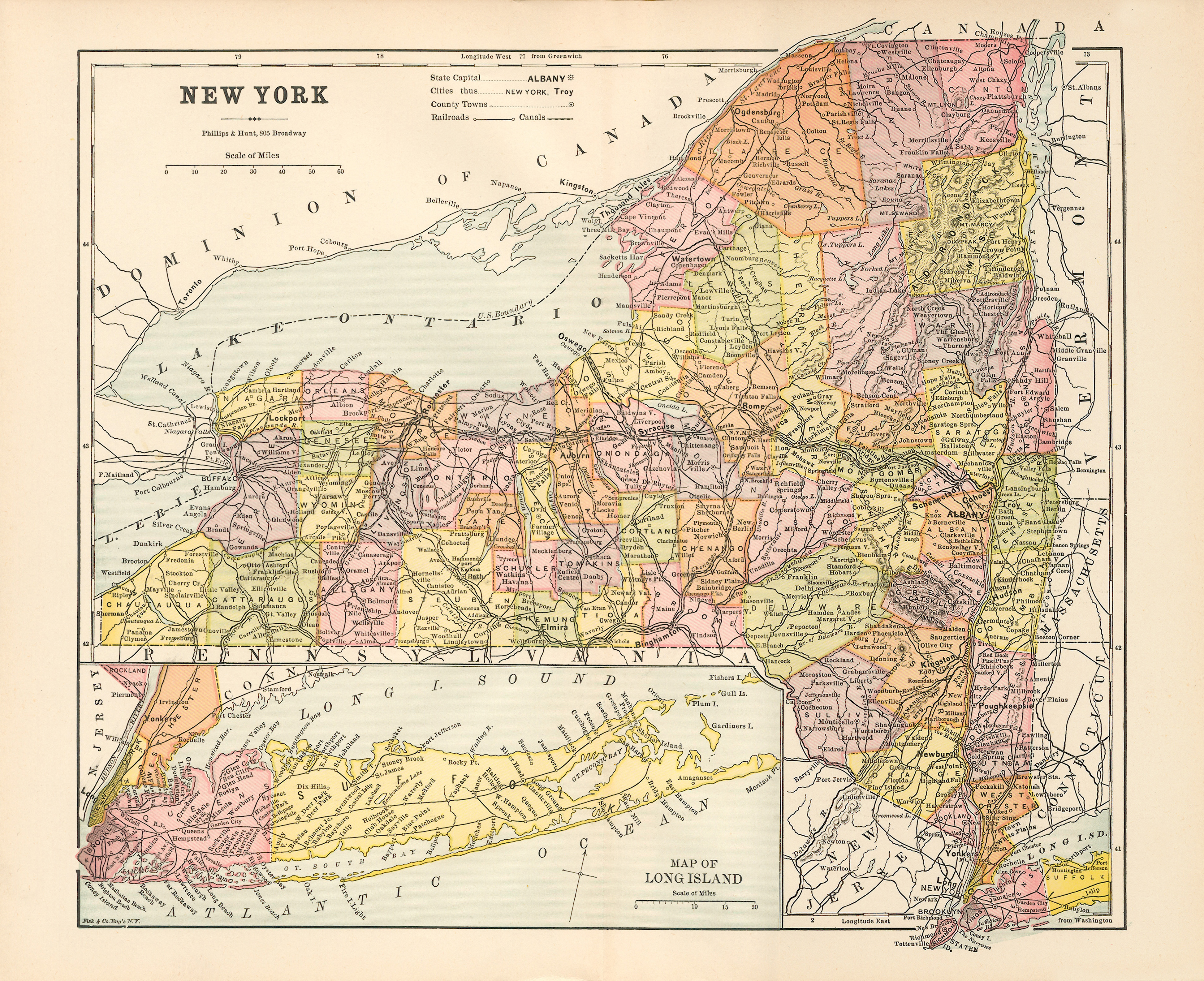 |
| "Map of the Canal, and Profile of the Canal" -- from: Marco Paul's Voyages & Travels, Erie Canal / by Jacob Abbott. (Harper & Brothers, New York, c1852) -- frontispiece. | "New York" (Phillips & Hunt; Fisk & Co, Engravers, 1882) -- 11 x 13 in. |
 |
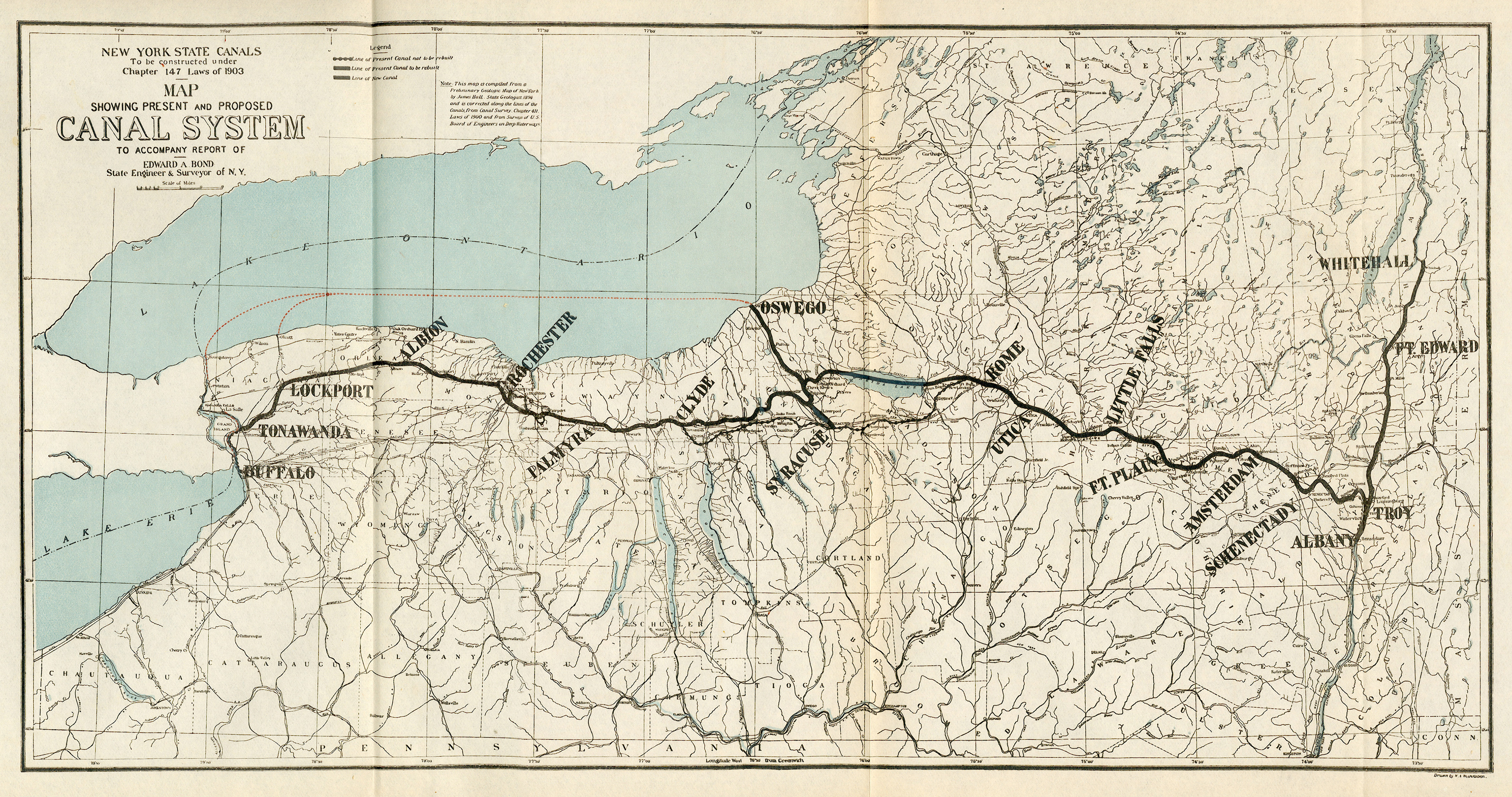 |
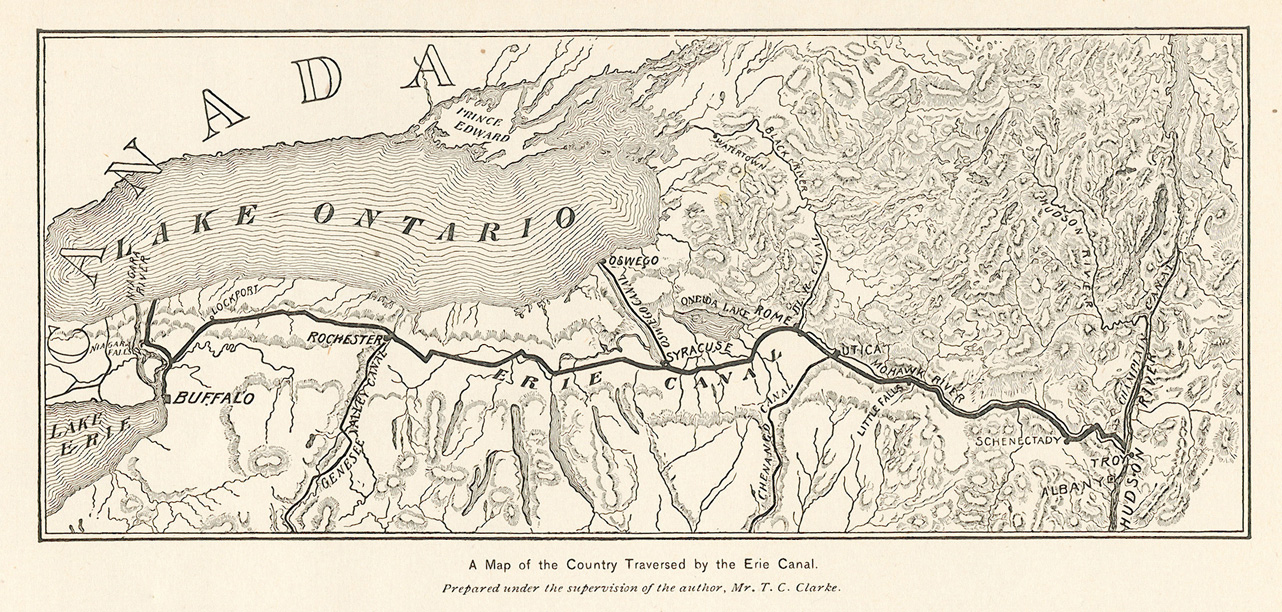
| "A map of the country traversed by the Erie Canal" -- from "Water-ways from the Ocean to the lakes" / by Thomas Curtis Clarke; in: Scribners Magazine, Vol. XIX, no. 15, 1896, p. 104. | "Map showing Present and Proposed Canal System" -- from: Annual report of the State Engineer and Surveyor of the State of New York, for the fiscal year ending September 30, 1903. (Albany : Oliver A. Quayle, 1904) -- facing p. 60. |
 |
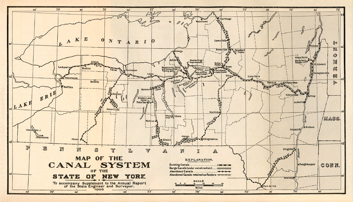 |
| "Route of the Barge Canal to be built across the State of New York" -- from: The Projected New Barge Canal of the State of New York / Thomas W. Symons -- in: Annual Report of the Board of Regents of the Smithsonian Institution ... for the year ending June 30, 1904 (Washington : Government Printing Office, 1905) -- facing p. 751. [Note that Symons' name is misspelled on the map] | "Map of the Canal System of the State of New York" -- from: History of the Canal System of the State of New York ... / by Noble E. Whitford (Albany : Brandow Publishing Co., 1906), facing p. viii -- original size: 8 x 14 cm. |
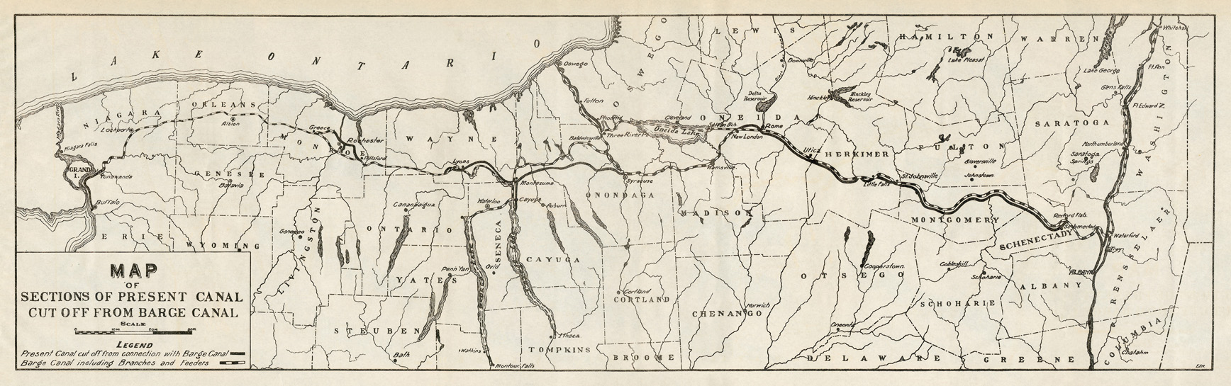 | |
| "Map of Sections of Present Canal cut off from Barge Canal" -- from: Annual report of the State Engineer and Surveyor of the State of New York for the fiscal year ended September 30, 1912. (Albany : J.B. Lyon Co., printers, 1913) -- facing p. 30. | |
 |
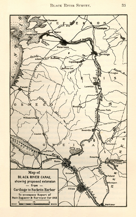 |
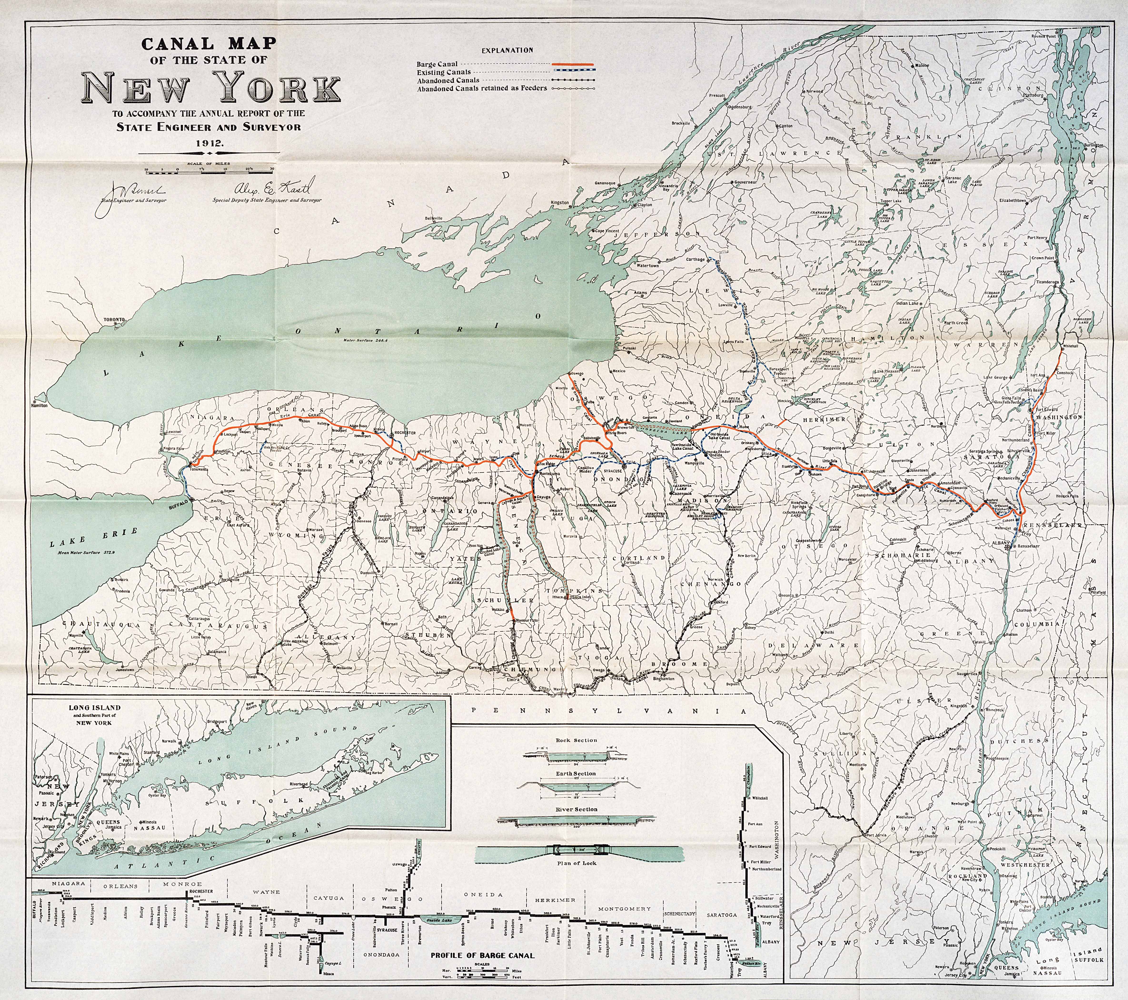
| "Canal Map of the State of New York" -- from: Annual report of the State Engineer and Surveyor of the State of New York for the fiscal year ended September 30, 1912. (Albany : J.B. Lyon Co., printers, 1913) -- 26 1/2 x 30 in. | "Map of Black River Canal showing proposed extension from Carthage to Sacketts Harbor" -- from: Annual report of the State Engineer and Surveyor of the State of New York for the fiscal year ended September 30, 1912. (Albany : J.B. Lyon Co., printers, 1913) -- p. 35. |
 |
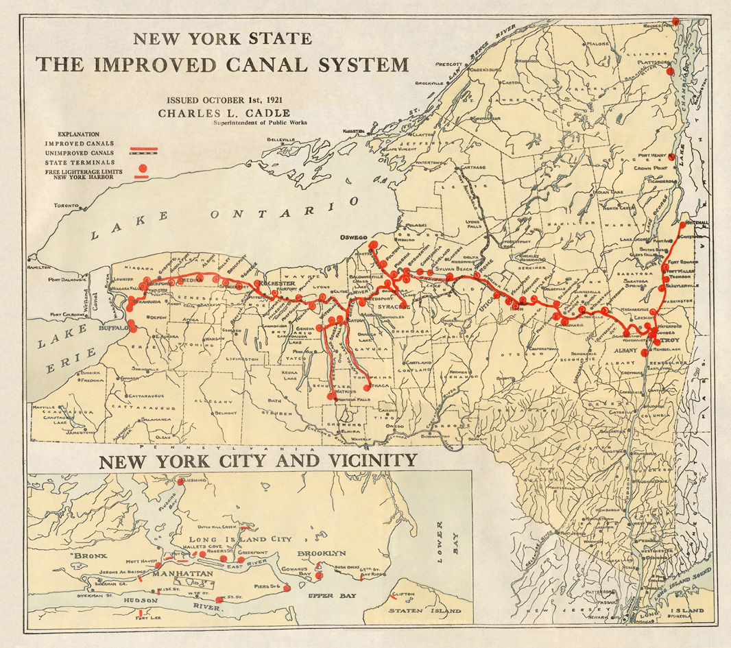 |
| "Canal Map of the State of New York Showing Location of Locks and Power Stations" -- from Annual Report of the State Engineer and Surveyor of the State of New York for the fiscal year ended September 30, 1915. (Albany : J. B. Lyon Co, printers, 1916) -- facing p. 36. | "New York State, The Improved Canal System" -- from: The Canal System of New York State / Charles L. Cadle -- Re-issued and revised. (Albany : J.B. Lyon Co., printers, 1921). |
 |
 |
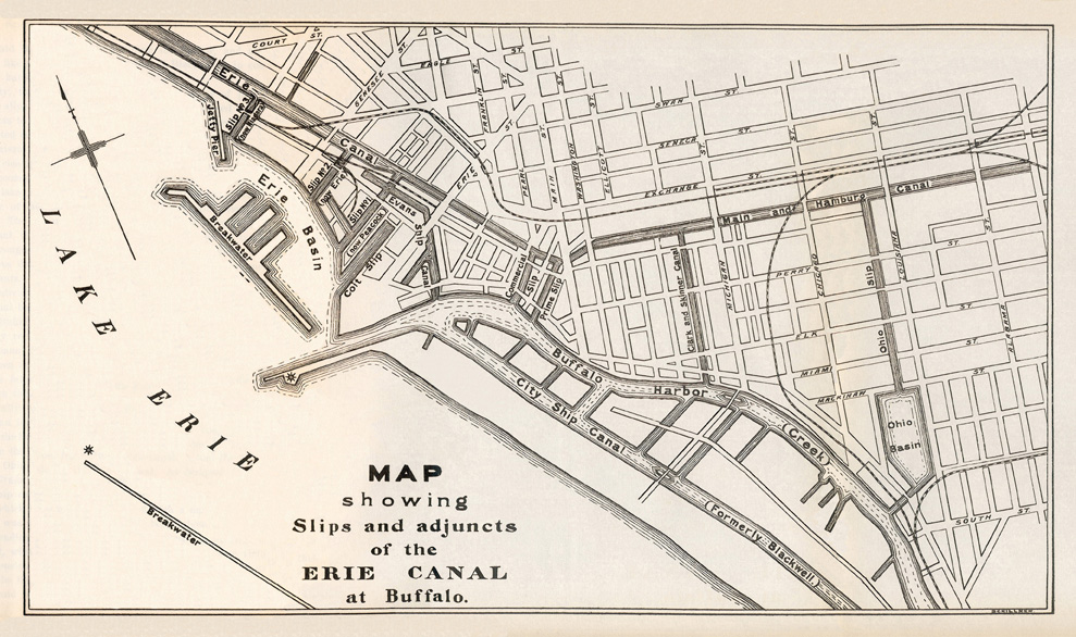
| "Map showing Slips and adjuncts of the Erie Canal at Buffalo" -- from: History of the Canal System of the State of New York ... / by Noble E. Whitford (Albany : Brandow Publishing Co., 1906) -- vol. 1, opposite p. 588. | The Erie Canal through Tonawanda, N.Y. -- from the topographic map: Niagara Falls and vicinity / U.S. Geological Survey, 1894. |
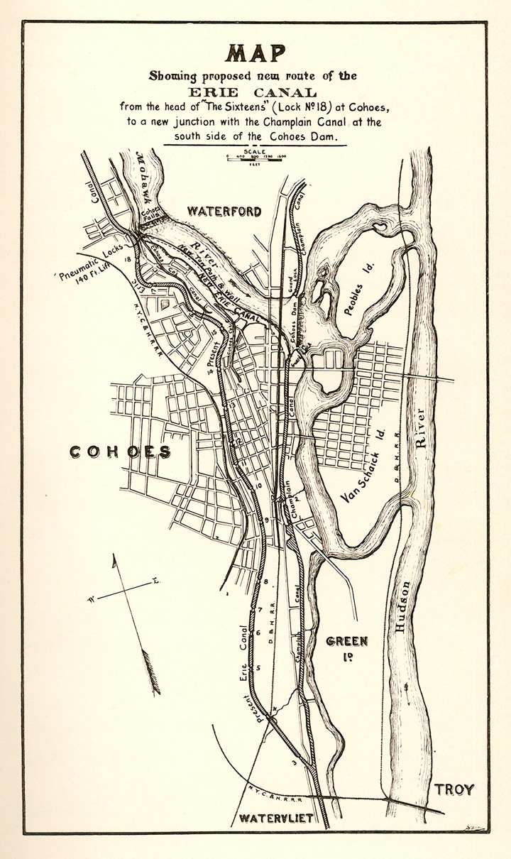 |
Left: "Map showing proposed new route of the Erie Canal from the head of "The Sixteens" (Lock No. 18) at Cohoes, to a new junction with the Champlain Canal at the south side of the Cohoes Dam" -- from: Annual report of the State Engineer and Surveyor of the State of New York, for the fiscal year ending September 30, 1897 (New York and Albany : Wynkoop Hallenbeck Crawford Co., state printers, 1898) -- facing p. 72. Note: This proposal was never implemented, being superseded by the development of the Barge Canal. |
 |
 |
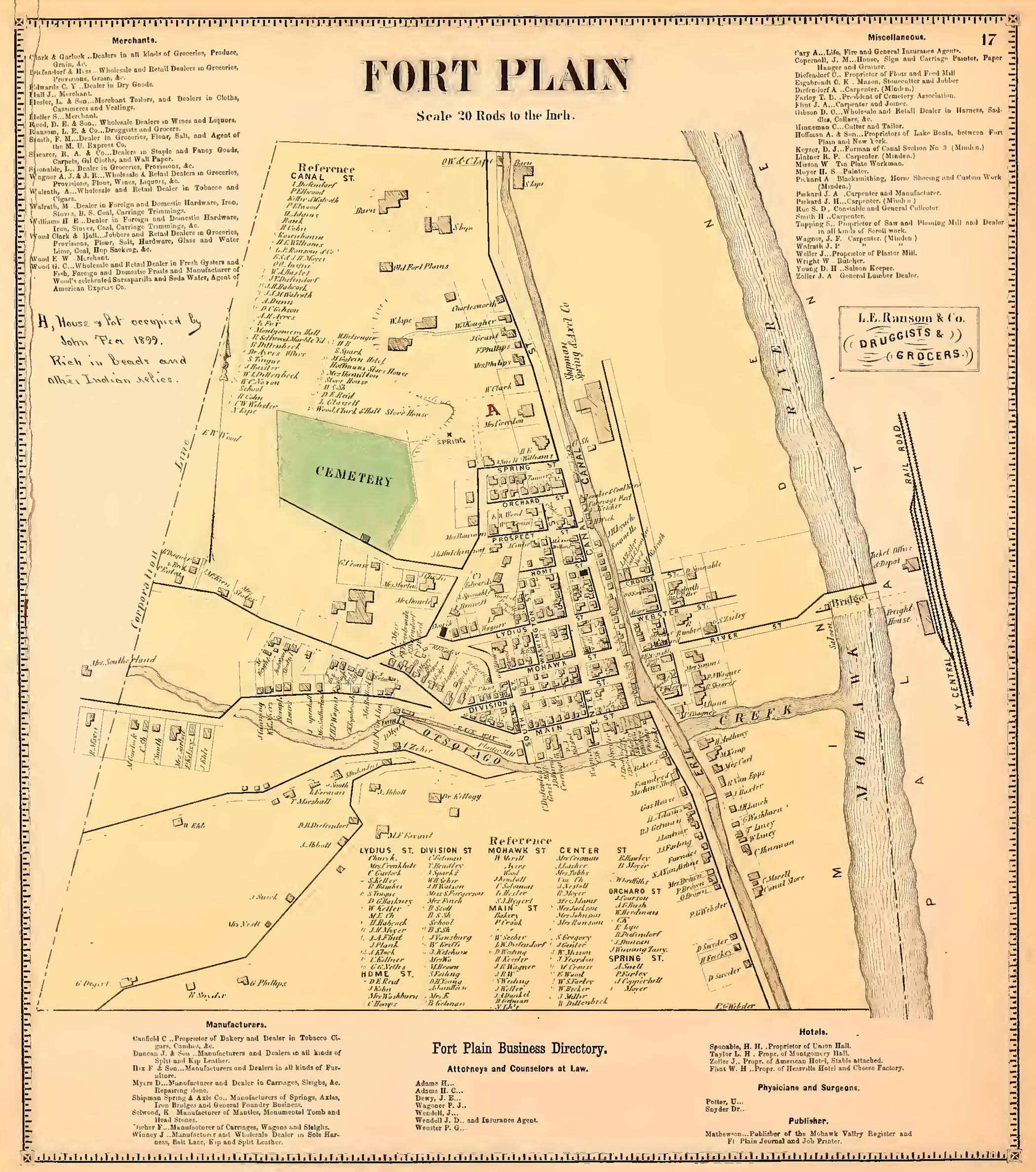
| Fort Plain [Village]; Fort Plain Business Directory -- from: Atlas of Montgomery and Fulton counties, New York ; from actual surveys by and under the direction of B. Nichols New York : J. Jay Stranahan & Beach Nichols, 1868) -- map 17. | [Map of Syracuse] -- a portion of: Topographic map of the Tully glacial series and adjoining areas -- from: The Tully glacial series, by O.D. von Engeln -- in: New York State Museum Bulletin (Albany : University of the State of New York), nos. 227-228, Nov.-Dec. 1919) -- facing p. 42. |
 |
 |
 |
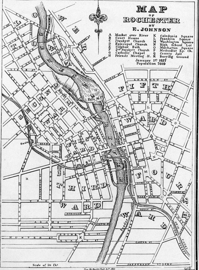
| Map of Rochester by E. Johnson, 1827 (Courtesy of the Rochester Historical Society) |
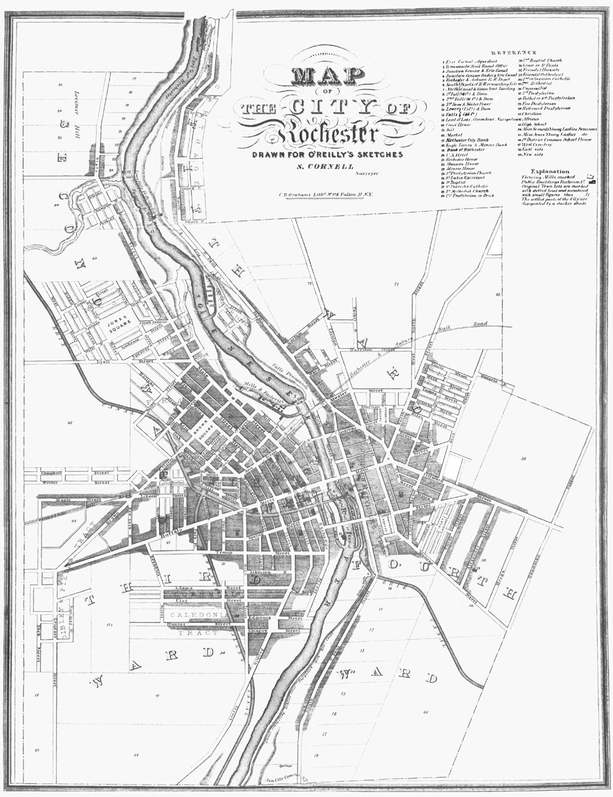
Map of the City of Rochester drawn for O'Reilly's Sketches by Silas Cornell, 1838 (C.B. Graham's Lithy.) Published by William Alling * |
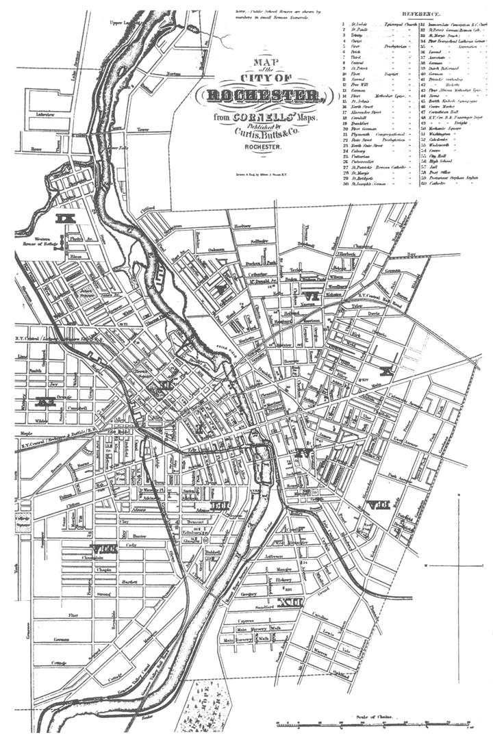
Map of the City of Rochester from Cornells' Maps by Silas Cornell, 1859 Published by Curtis, Butts & Co. |
| * Courtesy of the Department of Rare Books & Special Collections, University of Rochester Library. | ||
 |
 |
|
| Map of the City of Rochester from Cornells' Maps by Silas Cornell, 1861 Published by Curtis, Butts & Co. |
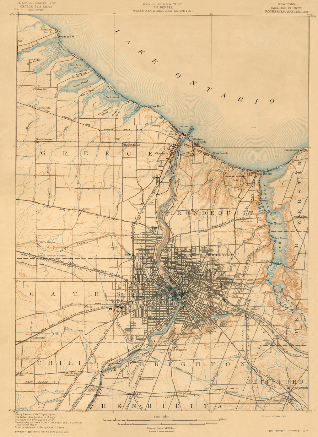
"Rochester Special Map" (U.S. Geological Survey ; State of New York, J.A. Bensel, State Engineer and Surveyor -- Edition of Mar. 1912) |
|
| Maps issued by The New York State Canal
Commission (a subsidiary of the New York State Thruway Authority): | |
 |
 |
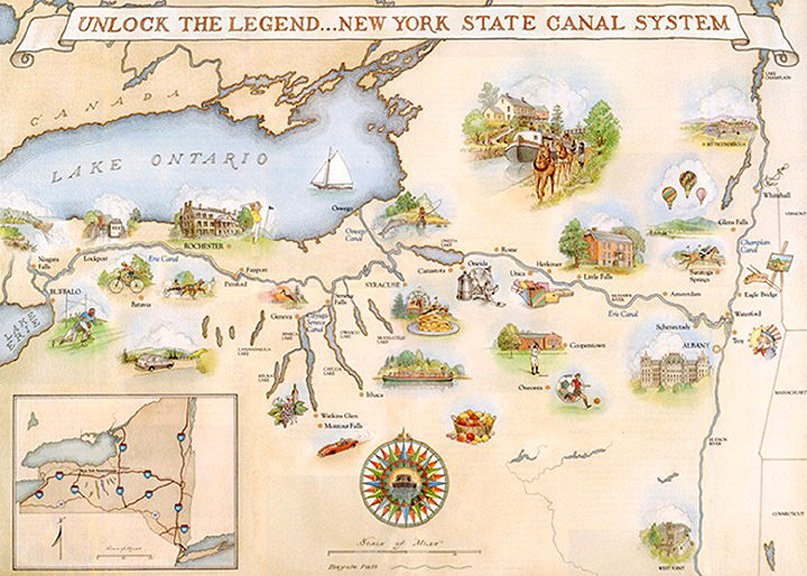
| The New York State Canal System (from "Unlock the Legend of The New York State Canal System" Published by The New York State Canal Commission) |
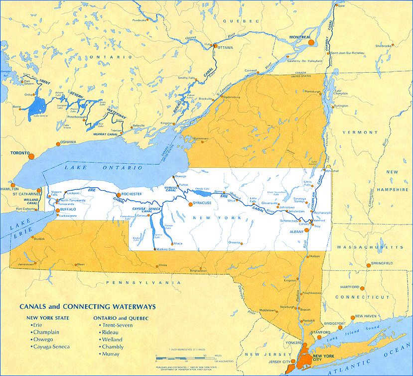
Canals and Connecting Waterways (from "Recreational Map and Guide to New York State Canals" pub. by the State Department of Transportation) |
 | |
| "New York State Canal System" -- from: New York State Canals, recreational map and guide. 6th ed. (New York State Canal Corporation, 1987) | |
http://www.eriecanal.org/maps.html