
Home | Canal System | Historical Documents | 175th Anniversary | Images | Maps | Tour | Traces | Locks | Boats | Books and Videos | Music | Links

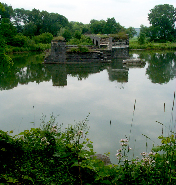
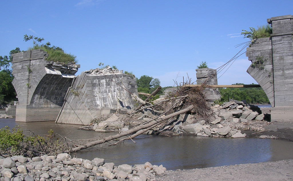
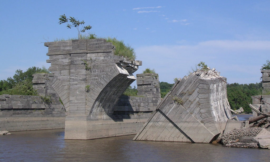
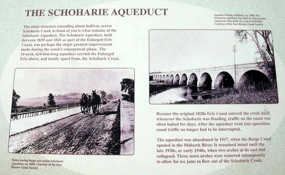
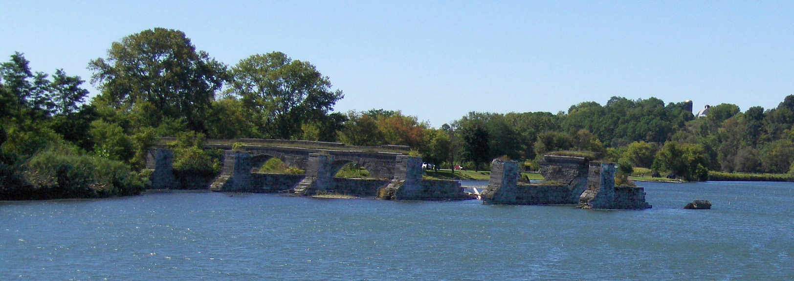
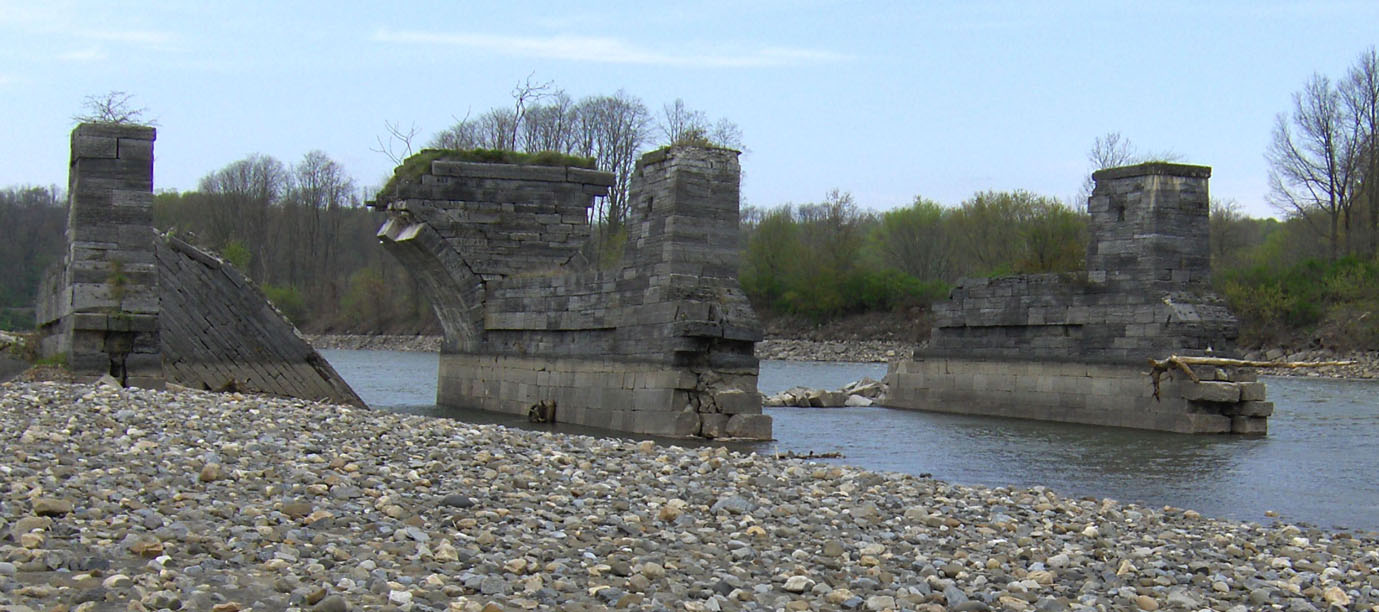
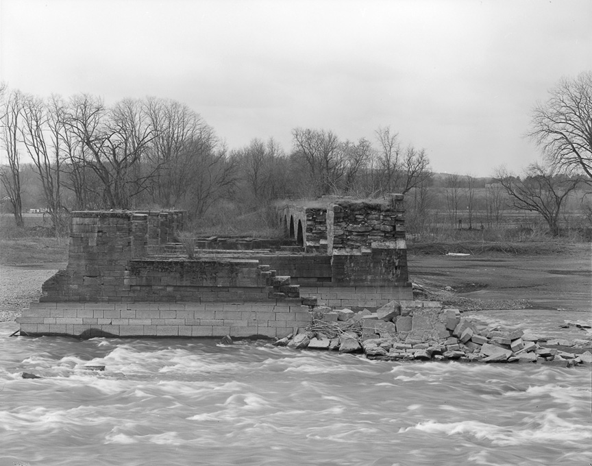
After the completion of the current Erie (Barge) Canal, the Schoharie Creek Aqueduct was abandoned, and the wooden trunk was removed. Since then, a combination of collapse, removal of 4 arches to avoid blockage of Schoharie Creek, and further collapse reduced the Aqueduct to six arches at the western end. The latest collapse occurred on August 16, 1998, and the result of that collapse can be seen in the pictures below.
In December 2022, construction began on a project to stabilize the six remaining arches of the Aqueduct. The stabilization project involved extensive repairs to the Aqueduct's foundation and structure. The project was completed on May 2, 2023. For details on this project, see the Stabilization of the Schoharie Creek Aqueduct page.
| Below: Photographs taken in 2004 by Patrick Chefalo
| ||
|---|---|---|
 |
 |
 |
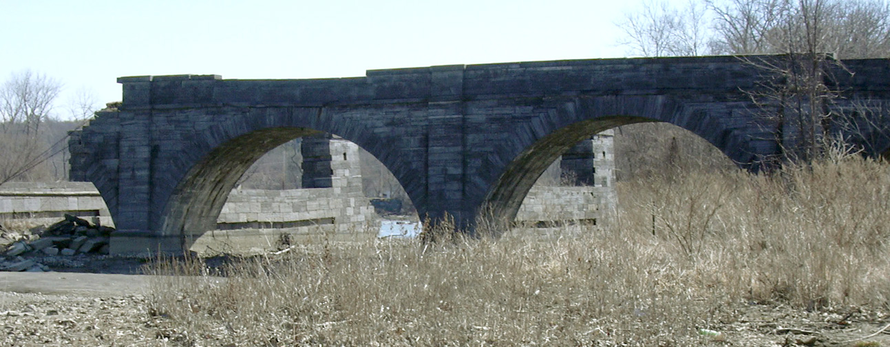
| Looking north from the eastern shore. | Looking east from the western end. | Looking west from the eastern shore. |
| Below: Photographs taken in 2006 by Howard Ohlhous
| ||
|---|---|---|
 |
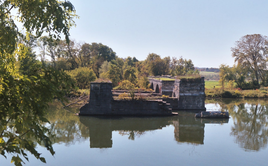 | |
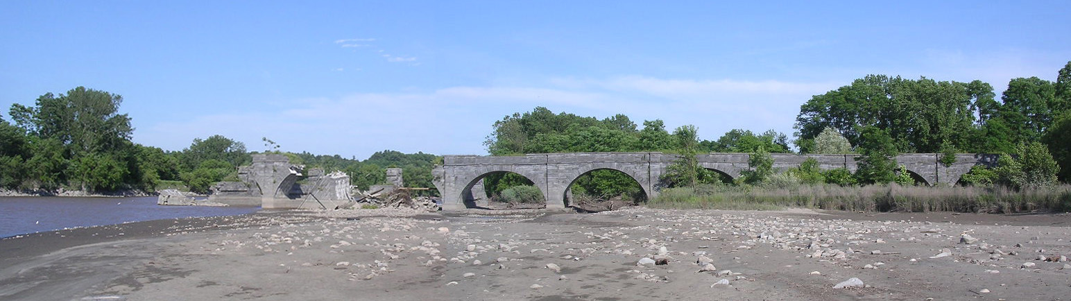
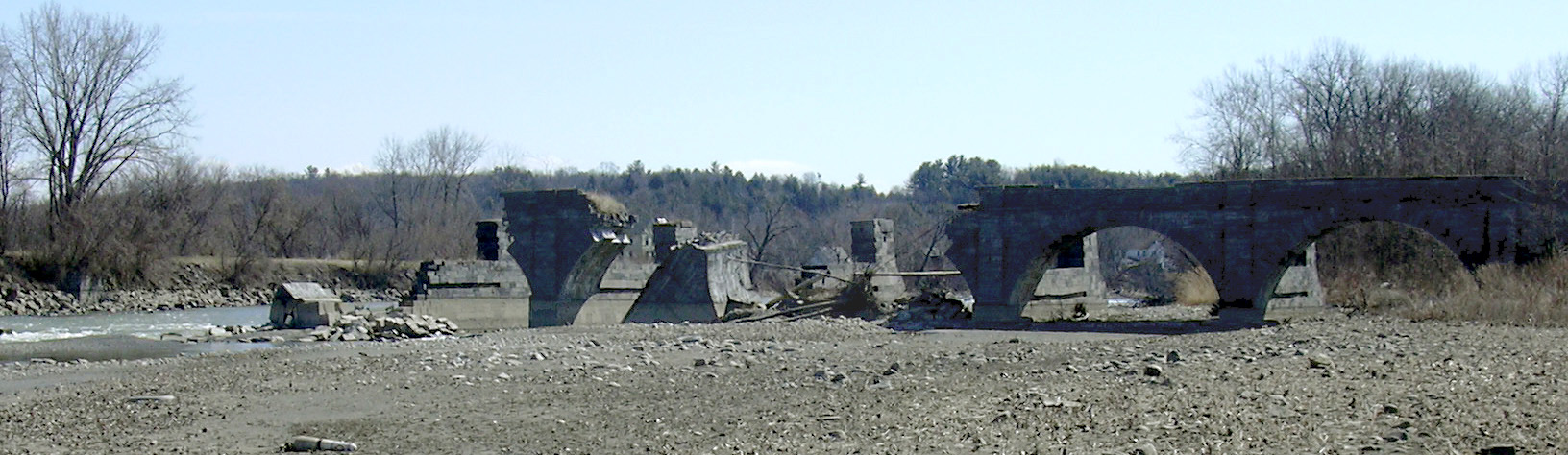
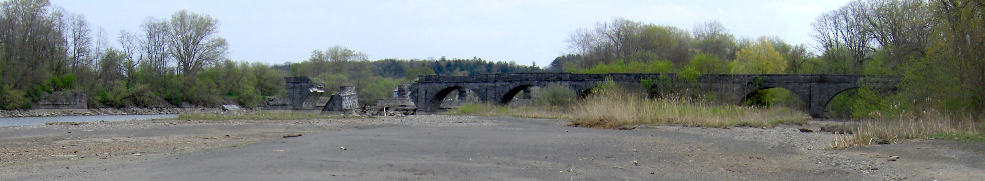
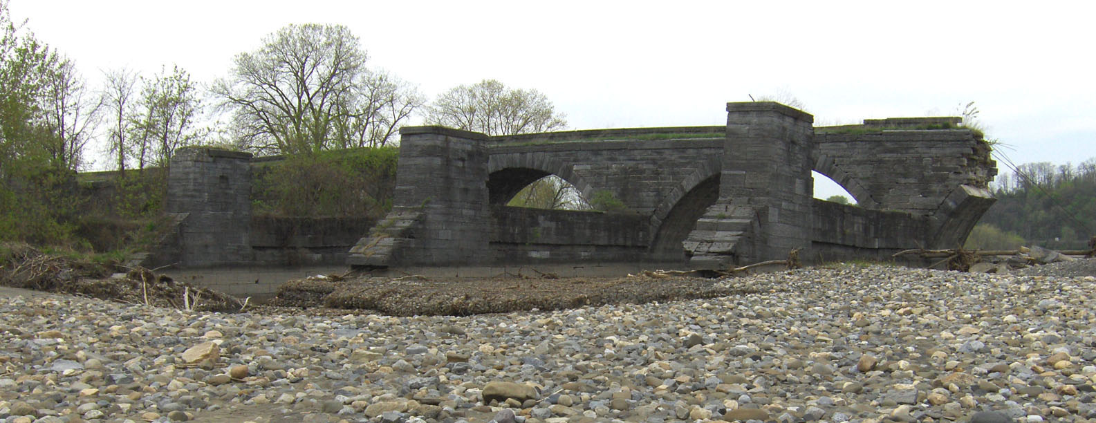
| Panoramic view of the remains of the Schoharie Creek Aqueduct, looking south up Schoharie Creek. The result of the August 16, 1998 collapse can be seen on the left. | Looking west across Schoharie Creek at the remains of the aqueduct. | |
 |
 |
 |
 |
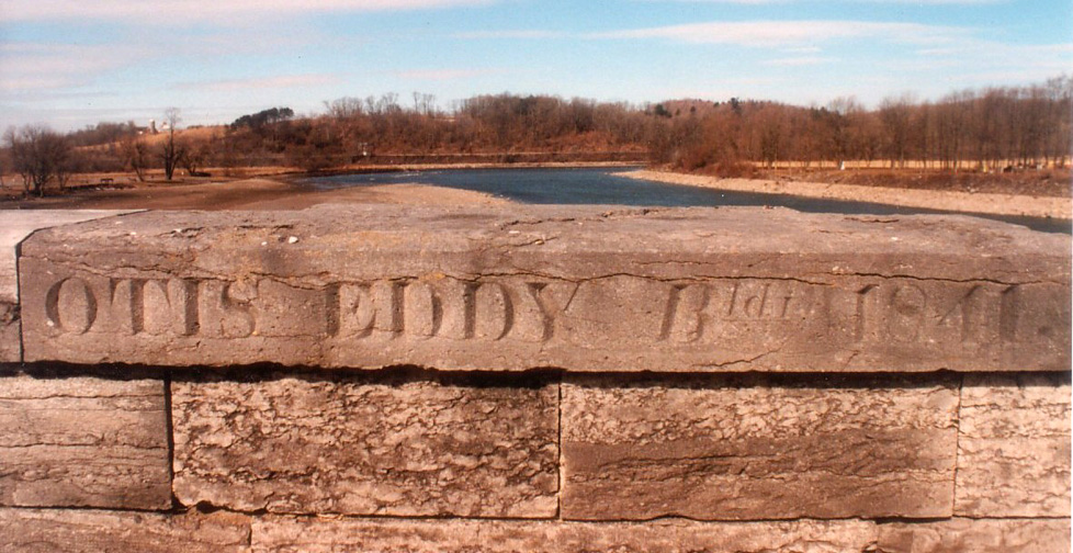 Part of the top rail of the tow path has the name of the contractor and the date of construction carved into it. |
 |
| Below: Photographs taken in April 2007, before the annual spring
refilling of the canal
| ||
|---|---|---|
 |
 | |
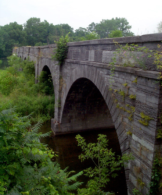
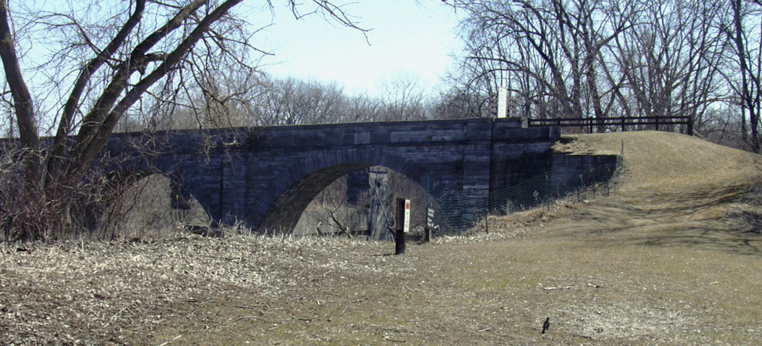
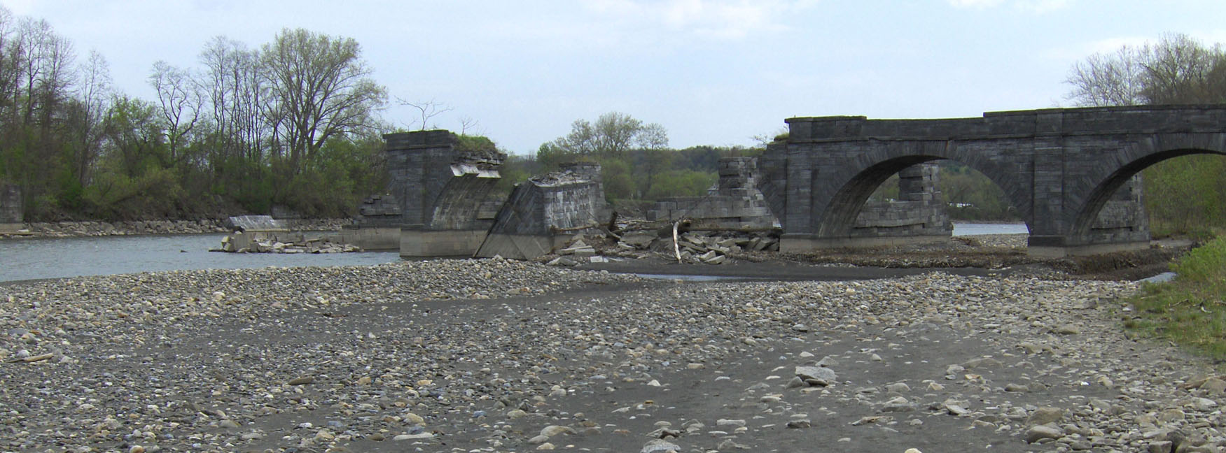
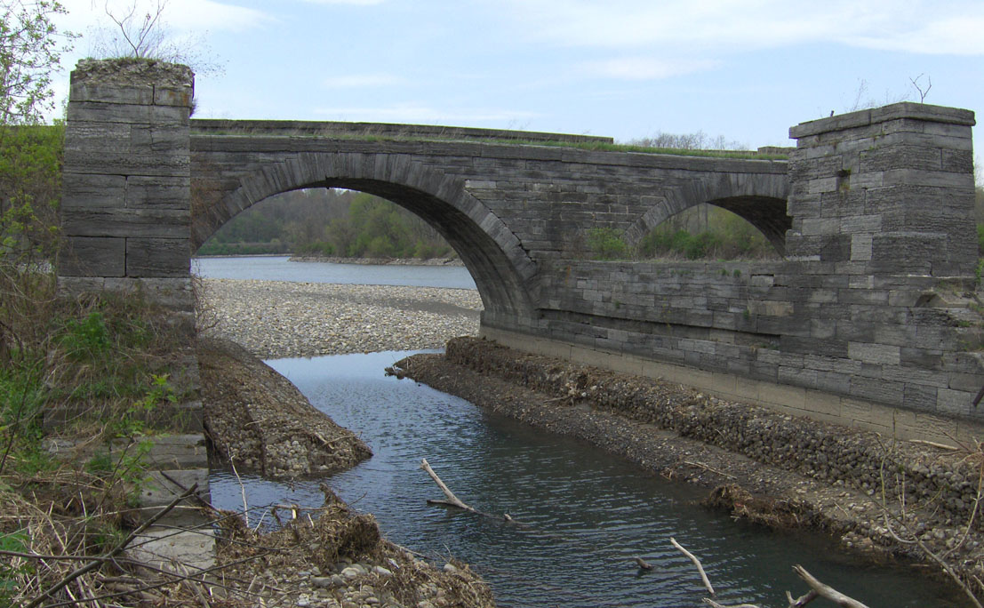
| Looking northwest, from the eastern bank. | The 5th and 6th arches (from the western end), looking south. | |
 |
 | |
| The collapsed center section, looking south. | The western end, looking south. | |
| Below: Photographs taken in September 2007
| ||
|---|---|---|
 |
 | |
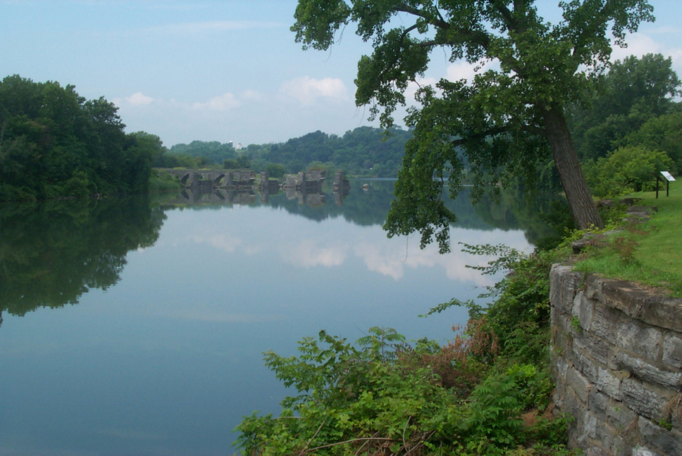
| Interpretive sign on the east bank of Schoharie Creek. | Looking northwest, from the eastern bank. | |
 |
 |
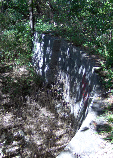 |
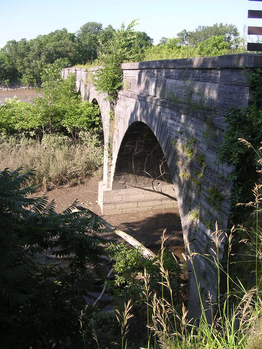
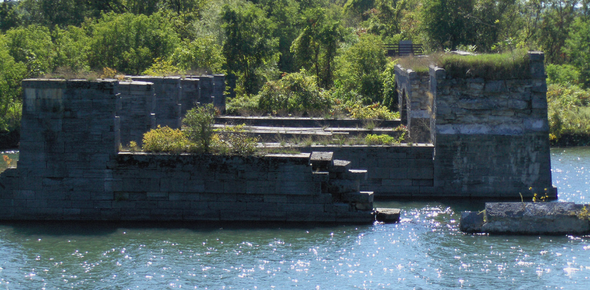
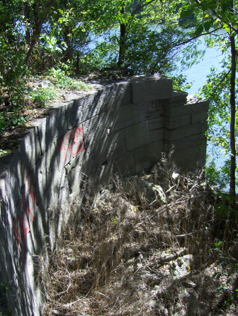
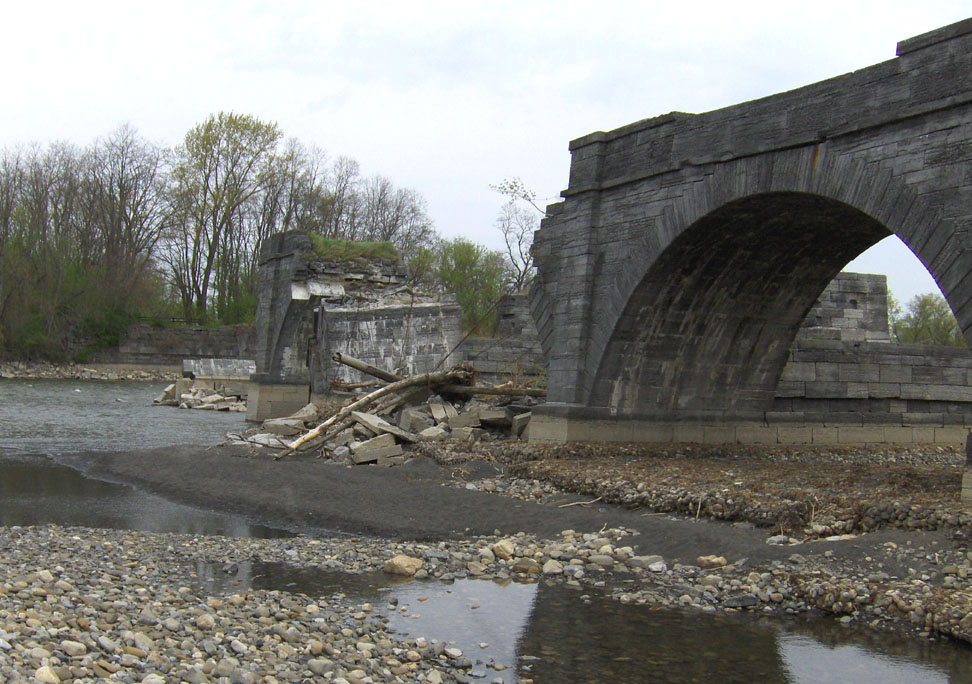
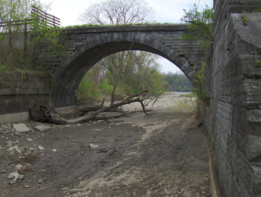
| Looking west at the remains of the aqueduct. The towpath arches are on the right (seen end on). | The east side retaining wall -- This is all that remains of the aqueduct on the east bank. Left: looking south ; Right: looking north. | |
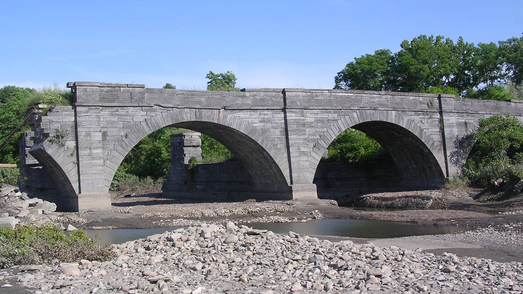
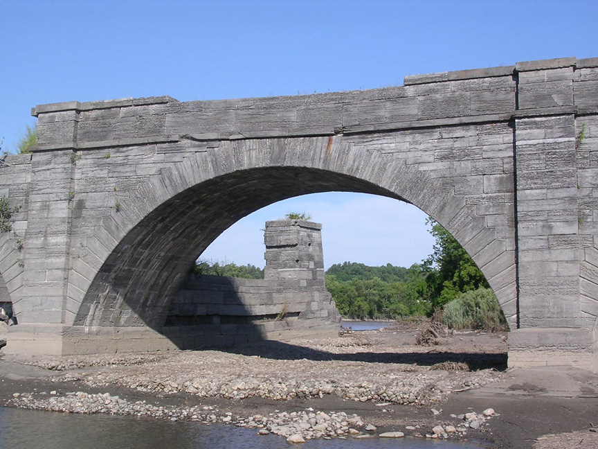
| Below: Photographs taken in April 2010, before the annual spring
refilling of the canal
| ||
|---|---|---|
 | ||
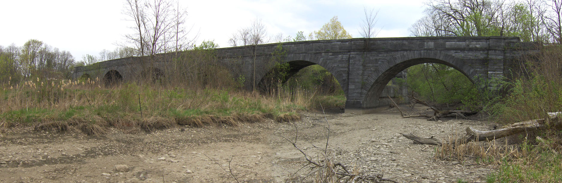
| Overall view of the remains of the Schoharie Creek Aqueduct, looking southeast up Schoharie Creek. | ||
 |
 |
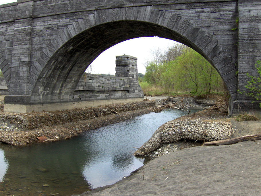 |
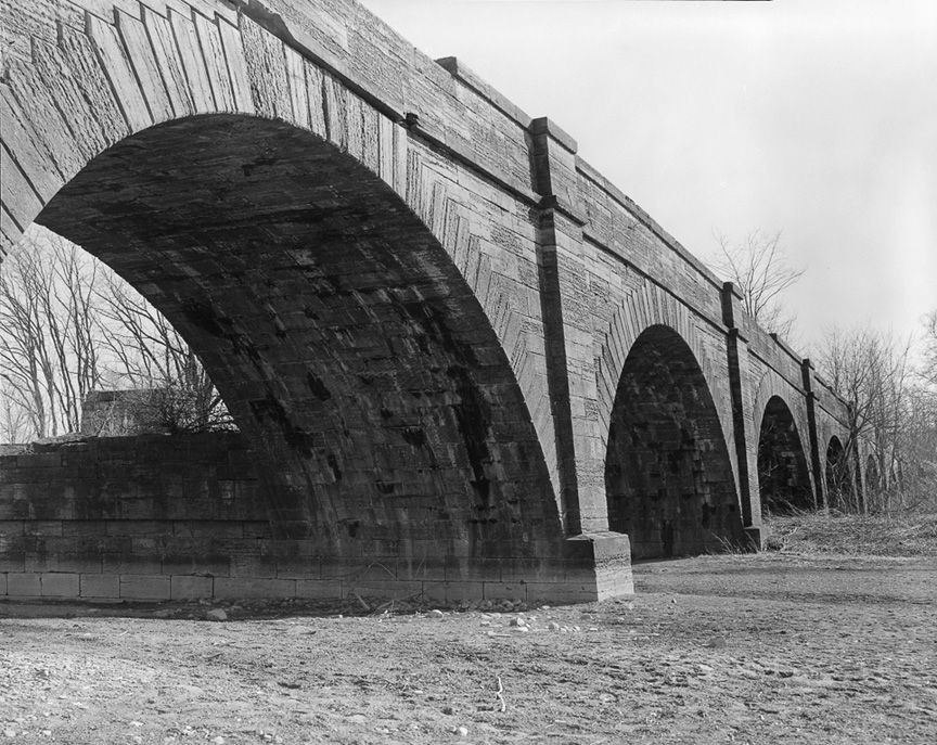
| Looking southeast up Schoharie Creek at the collapsed end of the aqueduct. | Looking east, with the eastern end pier visible on the left across Schoharie Creek. | Looking southeast through the third western towpath arch at the prism trunk support and pier. |
 |
 |
 |
| Looking northwest from the bed of Schoharie Creek on the southwest side. | Looking north at the collapsed piers. | Closeup of the eastern end, looking northeast from across Schoharie Creek. |
 |
 |
 |
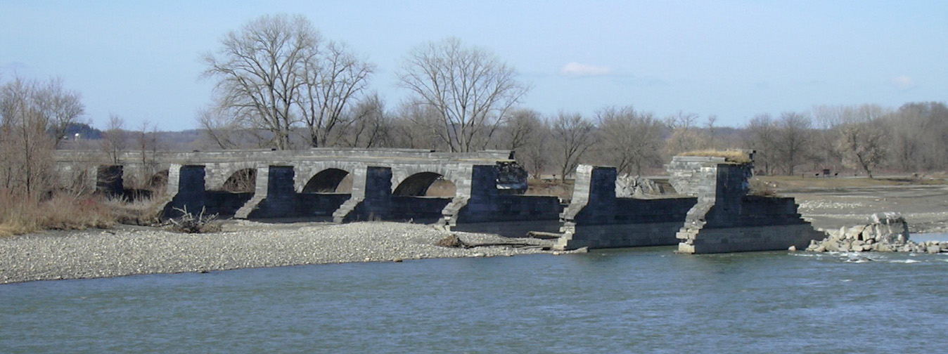
| Looking northwest from the southwest side. | Looking north at the westernmost arch. | Panoramic view of the remaining towpath arches, looking southeast. |
| Below: Photographs taken April 11, 2018 by Bruce Harvey Courtesy of The Preservation League of New York State
| ||
|---|---|---|
 |
 |
|
| Schoharie Creek Aqueduct, north side looking west. | Schoharie Creek Aqueduct, looking west from the east bank. | |
http://www.eriecanal.org/SchoharieAqueduct-2.html