
Home | Canal System | Historical Documents | 175th Anniversary | Images | Maps | Tour | Traces | Locks | Boats | Books and Videos | Music | Links

The Schoharie Crossing State Historic Site is located at Fort Hunter, Town of Florida, in Montgomery County, NY, and includes a two mile long segment of the original Old "Clinton's Ditch" Erie Canal, an Old Erie Canal guard lock, the original Old Erie Canal 'Empire' Lock No. 20, the Enlarged Erie Canal 'Empire' Lock No. 29, the Enlarged Erie Canal 'Yankee Hill' Lock 28, and the remains of the Schoharie Creek Aqueduct. Nearby is the 'Tribes Hill' Lock No. 12 of the Erie (Barge) Canal that is still in use today.
Faced with the problem of finding a way for the canal to cross Schoharie Creek, the canal's engineers' initial solution was to build a dam across the creek, creating a slackwater pool across which a rope and windlass system pulled the canal boats with their horses or mules riding on the boats. unfortunately, the waters of Schoharie Creek were often dangerously turbulent, and a number of people, animals and boats were lost. In addition, the dams were frequently washed out by floods and ice. A towpath bridge attached to the Florida Bridge Company's toll bridge across the creek, in use between 1829 and 1845, suffered the same problems. The final solution was the building of a 624-foot long, 14-arch aqueduct.
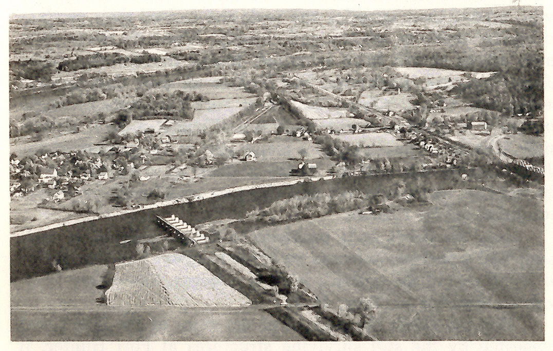 |
Left: "Aerial view [of Fort Hunter area]" -- from: Fort Hunter - “Canal-Town, U.S.A.” / by David H. Veeder. (Fort Hunter, N.Y. : Fort Hunter Canal Society ; printed by The Noteworthy Co., Amsterdam, N.Y., c1968) -- p. 17. The "Clinton's Ditch" canal trace can be seen in the field at lower right, continuing across the creek through the line of trees. The remains of the Schoharie Creek Aqueduct can be seen in the creek at left center. After crossing the creek, the Enlarged Erie Canal turned to the northeast, paralleling the angled line of trees. |
 |
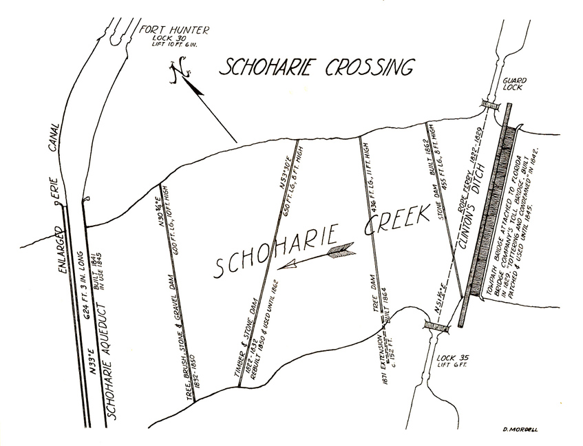 |
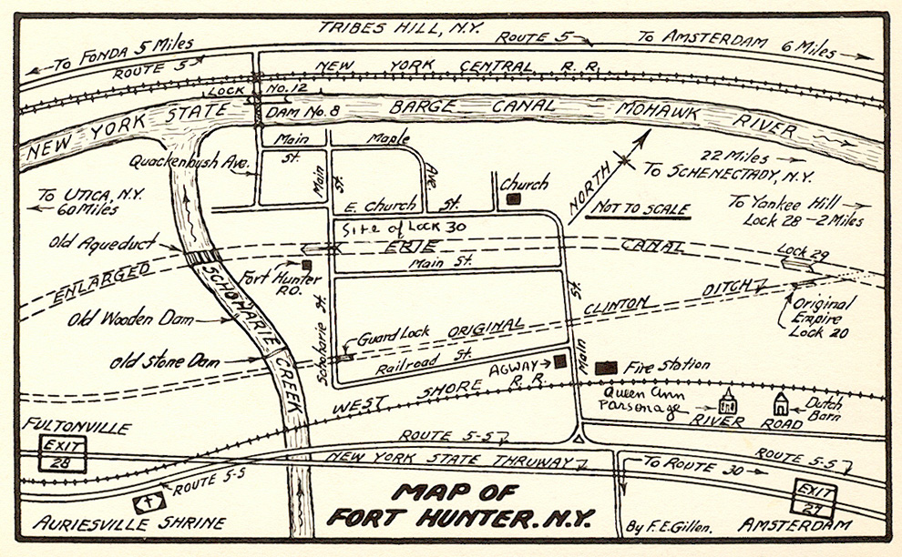
| "Map of Fort Hunter, N.Y." / By F.E. Gillen -- from: Fort Hunter - "Canal-Town, U.S.A." / by David H. Veeder. (Fort Hunter, N.Y. : Fort Hunter Canal Society ; printed by The Noteworthy Co., Amsterdam, N.Y., c1968) -- back cover. [Not to scale.] | Map of the various dams across Schoharie Creek, in relation to
their successor, the Schoharie Creek Aqueduct -- From the article: "Schoharie Crossing" / by D. Mordell (in: Bottoming Out / Canal Society of New York State -- No. 18-19, 1962, p. [8-9]) |
 |
Left: Google Earth view of Fort Hunter and Schoharie Crossing State Historic Site, October 7, 2011. "Clinton's Ditch" canal remains visible include the Guard Lock, the canal trace (yellow circles), and "Empire" Lock No. 20. Enlarged Erie Canal remains visible include the Schoharie Creek Aqueduct, the canal trace (red circles), and "Empire" Lock No. 29. |
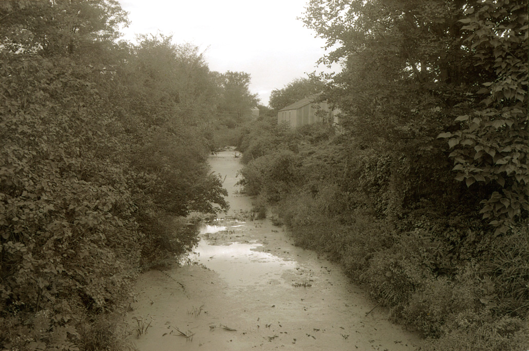
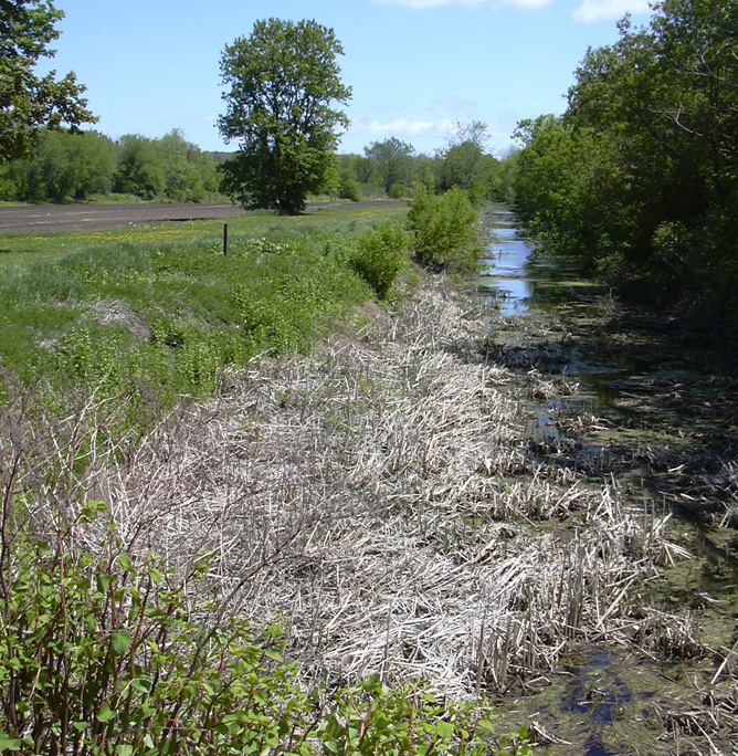
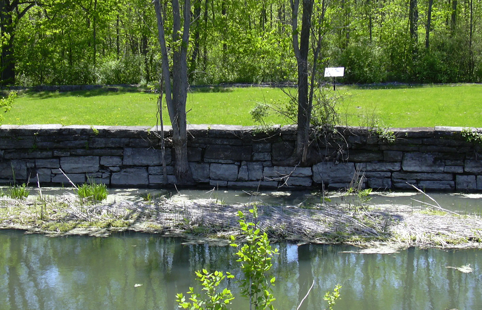
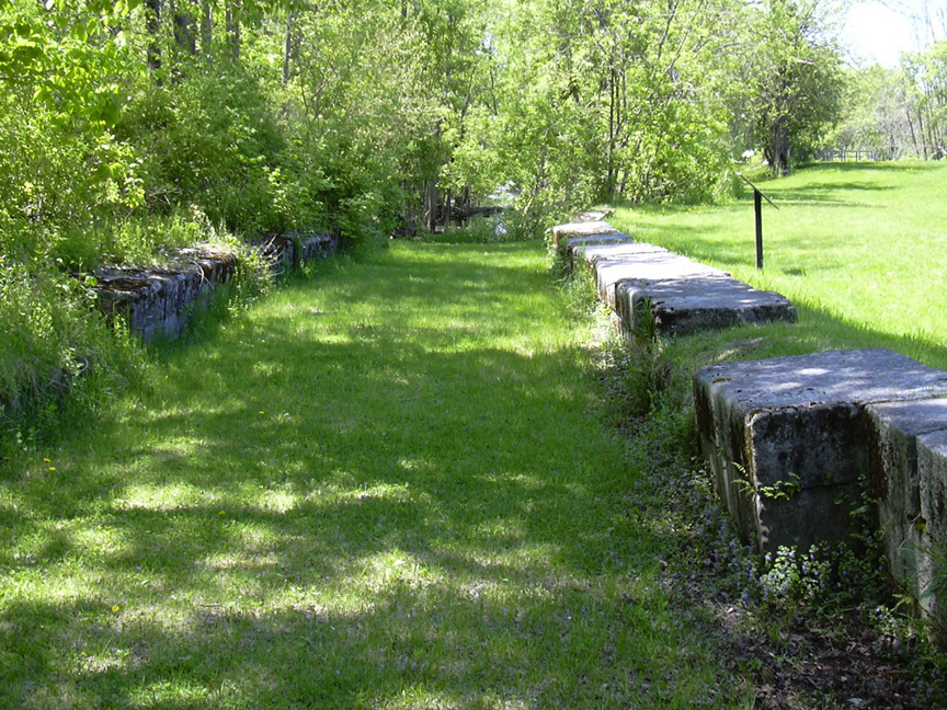
The "Clinton's Ditch" canal trace still has some water in it, as can be seen in the following images:
 |
 |
|
| "Clinton's Ditch" Erie Canal, Fort Hunter, N.Y. -- taken in 1959 by Dante Tranquille. | Remains of "Clinton's Ditch" at Fort Hunter, NY -- looking east from the Schoharie Creek guard lock -- taken in May 2007. |
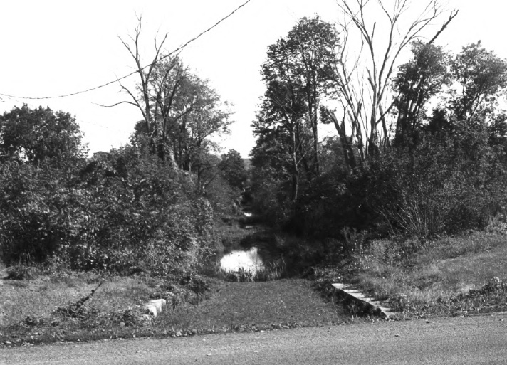
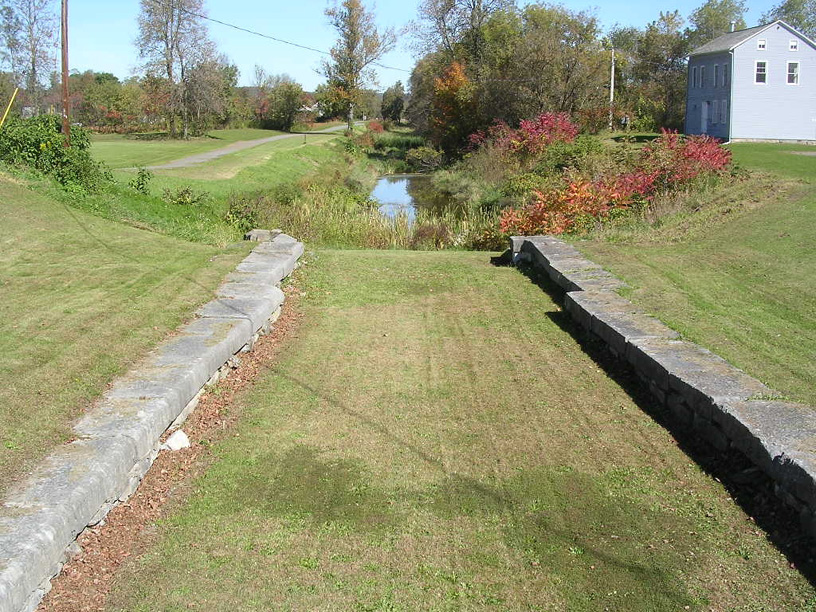
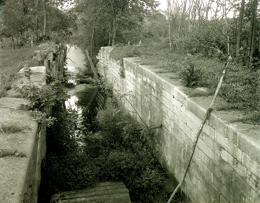
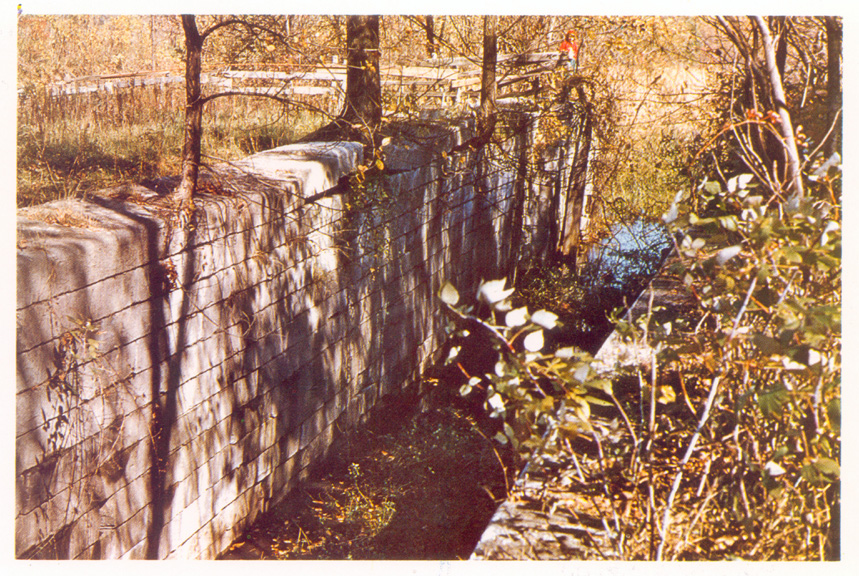
The Schoharie Crossing Guard Lock was located on the east bank of Schoharie Creek. It protected the canal from being washed out or filled with silt in times of high water. Unlike lift locks, guard locks' gates normally stood open, allowing free passage of canal boats. In times of high water, the gates were closed and boats were locked through. The Schoharie Crossing Guard Lock was built in 1820 from stones of the 1712 Queen Anne Chapel, which was removed because it was in the path of the canal.
 |
 |
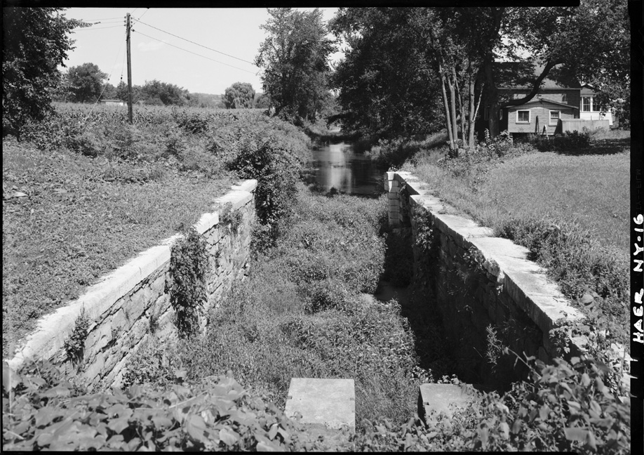 |
| "The East Guard Lock" -- from: A Preliminary Proposal for a New York State Canal Museum and Lock Restoration Project, 1955 -- facing leaf 6. | "Guard Lock at Schoharie Creek - 1822" -- from: Fort Hunter - "Canal-Town, U.S.A." / by David H. Veeder. (Fort Hunter, N.Y. : Fort Hunter Canal Society ; printed by The Noteworthy Co., Amsterdam, N.Y., c1968) -- p. 7. | Schoharie Creek Guard Lock, photographed in 1970 -- from the Historic American Engineering Record of the Library of Congress, HAER NY,29-FORHU,2B-3 |
 |
 |
 |
| "Erie Canal National Historic Landmark, Glen and Florida, Montgomery Co., NY" (Oct. 1983) -- View east into East Guard Lock (from National Park Service site). | Remains of the guard lock at Schoharie Crossing State Historic Site -- Taken by Howard Ohlhous, Fall 2006. | Guard Lock, Original Clinton's Ditch Erie Canal -- entrance from Schoharie Creek -- taken in April 2007. |
 |
 |
 |
| Guard Lock, Original Clinton's Ditch Erie Canal -- looking east down the original Erie Canal prism -- taken in April 2007. | Guard Lock -- looking southeast, with the remains of Clinton's Ditch in the background -- taken in May 2007. | Guard Lock -- looking southwest, toward Schoharie Creek -- taken in May 2007. |
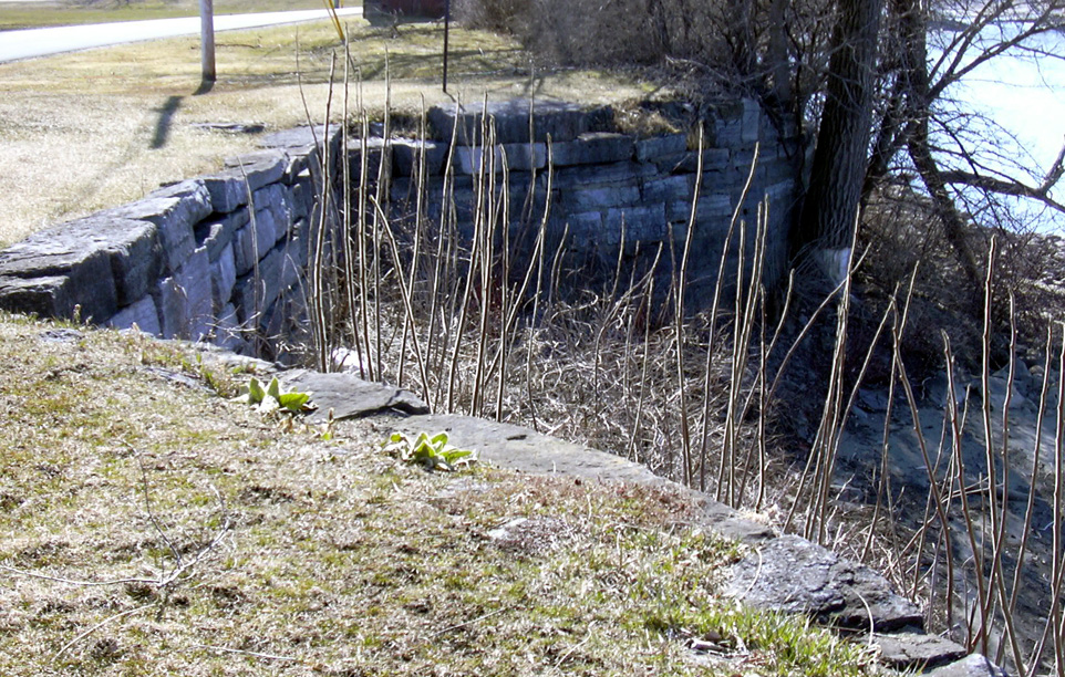
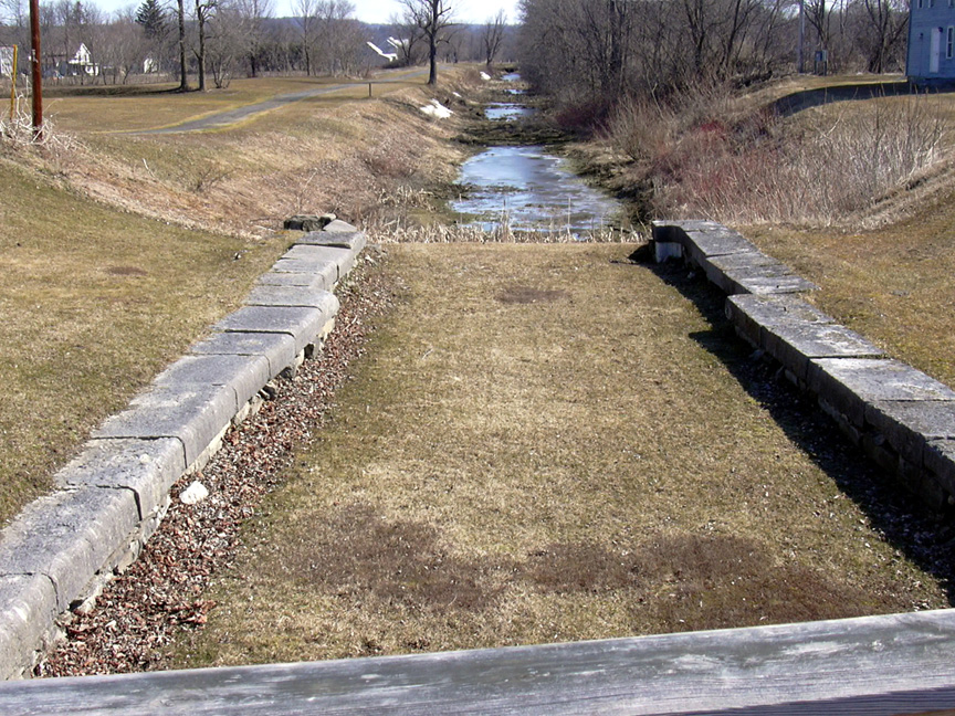
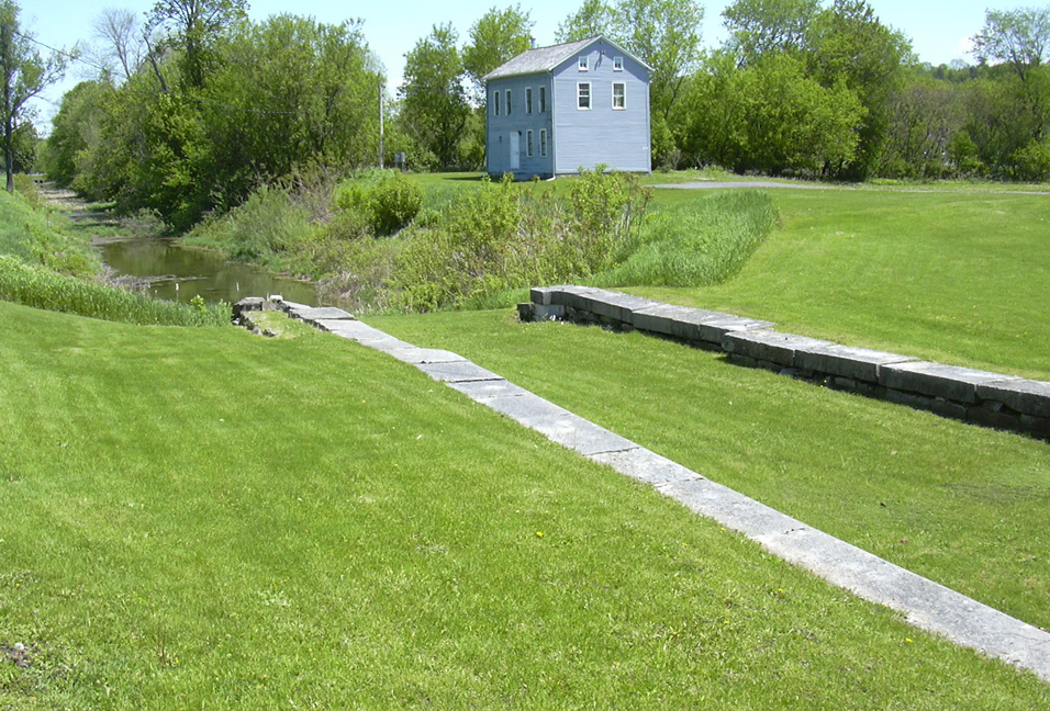
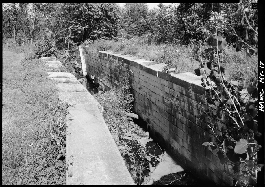
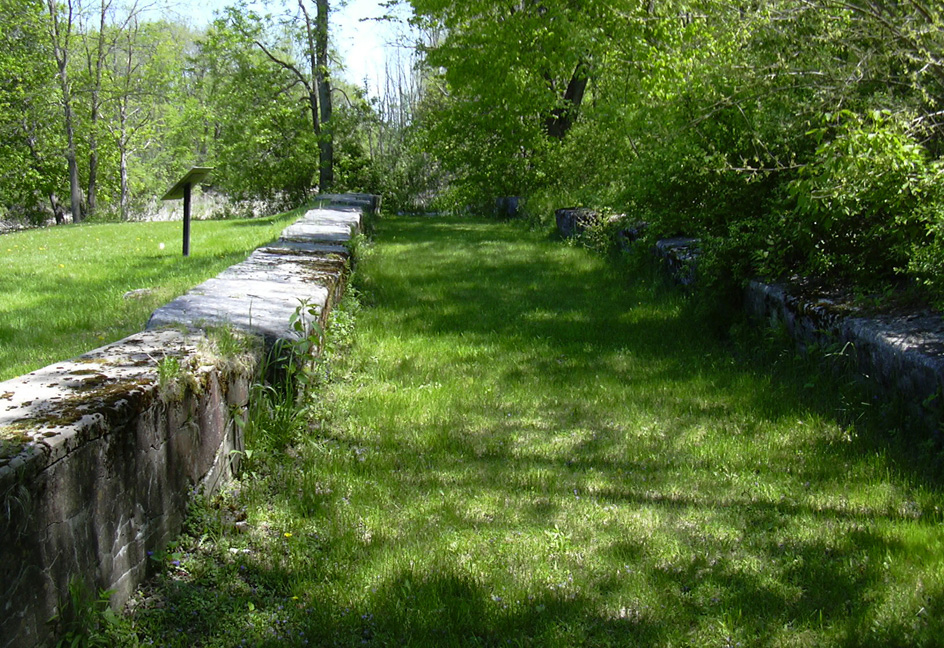
Empire Lock No. 20 was a lift-lock on the original Erie Canal, built in 1822 and having a lift of four feet. It is located about a mile east of the original guard lock at the edge of Schoharie Creek, and is adjacent to Enlarged Erie Canal Lock No. 29. Due to the likelihood of collapse, the lock was filled with gravel and dirt in 1980, and only the top of the lock is visible at present. This and the Guard Lock are the only surviving locks from Clinton's original ditch.
 |
 |
 |
| Enlarged Erie Canal Lock No. 20, looking east -- taken by Dante Tranquille in the 1950s(?) | "Original Canal Lock (1820)" -- from: A Preliminary Proposal for a New York State Canal Museum and Lock Restoration Project, 1955 -- facing leaf 6. | "Original Empire Lock, 1822" -- from: Fort Hunter - "Canal-Town, U.S.A." / by David H. Veeder. (Fort Hunter, N.Y. : Fort Hunter Canal Society ; printed by The Noteworthy Co., Amsterdam, N.Y., c1968) -- p.8. |
 |
 |
|
| "Erie Canal, Fort Hunter, New York -- This lock dates from the
original canal" [Lock No. 20, looking east] -- Taken October, 1958 ; from the
National Park Service (http://pdfhost.focus.nps.gov/docs/NHLS/ Photos/66000530.pdf} |
Old Erie Canal "Empire" Lock No. 20, photographed in 1969 -- from the Historic American Engineering Record of the Library of Congress (http://memory.loc.gov/ammem/collections/habs_haer/) HAER,NY,29-FORHU,2C-1 |
| Below -- Pictures of Old Erie Canal "Empire"
Lock No. 20, taken from within the prism in May 2007: Because the walls of this lock were leaning inwards (especially noticeable in the picture above right), the lock was filled with gravel in 1980 to keep it from collapsing. | ||
 |
 |
|
| Lock No. 20 -- looking east, with the remains of the Enlarged Erie Canal on the left. | The Enlarged Erie Canal just east of "Empire" Lock No. 29 in the foreground, with Clinton's Ditch "Empire" Lock No. 20 in the background. | |
 |
 |
 |
| Lock No. 20 -- looking west , with Clinton's Ditch in the center background, and Enlarged Erie Canal "Empire" Lock No. 29 at extreme right. | Lock No. 20 -- looking west, with Clinton's Ditch in the center background. | |
http://www.eriecanal.org/Schoharie.html